Willkommen bei MapFox
Wurde Ihre Bestellung bestätigt? Wenn nicht - gab es evtl. ein SERVER-Problem! Bitte kontaktieren Sie uns! +++ Buchhändler-Anfragen erwünscht +++
Warenkorb
Artikel: 0 - € 0.00
Zur Kasse
Impressum Kontakt Versandkosten AGB
Dorset South West Coast Path Adventure Geographers` A-Z Großbritannien
<< Großbritannien: Wanderkarten, Radwanderkarten und MTB-Karten
<< Geographers A-Z
 
Cover

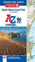
The South West Coast Path is a National Trail along the Somerset, Devon, Cornwall and Dorset coasts. This stunning walk from Minehead, Somerset covers 630 miles to South Haven Point in Poole Harbour, passing through two World Heritage Sites (the Jurassic Coast and the Cornwall and West Devon Mining Landscape), Exmoor National Park, Land`s End and many areas of outstanding natural beauty.

This A-Z Adventure Atlas of the SW Coast Path Dorset features 36 pages of continuous Ordnance Survey mapping covering the SW Coast Path from Lyme Regis, following the route east, to its finishing point at South Haven Point in Poole Harbour. The alternative shorter route along the South Dorset Ridgeway is also shown. Clearly highlighted in yellow, to stand out from the many other footpaths, the path is easy to identify. In addition mileage markers have been introduced to the map making it easy to gauge distances when planning your own sections of the walk to enjoy.

A route planner providing the distances between places and the amenities available, featuring:
?Information Centres
?Visitor Centres
?Hotels/B&amp;Bs
?Youth Hostels
?Campsites (seasonal opening)
?Public Houses
?Shops
?Restaurants
?Cafes (seasonal opening)
?Petrol stations

Also featured is a selection of QR codes linked to useful websites.

The South West Coast Path is covered by the following five titles in the A-Z Adventure series:
?SW Coast Path North Devon and Somerset
?SW Coast Path North Cornwall
?SW Coast Path South Cornwall
?SW Coast Path South Devon
?SW Coast Path Dorset

Kartenausschnitt

Kartenbeispiel

Dorset South West Coast Path Adventure Geographers` A-Z Großbritannien
EAN / ISBN: 9781782571544
Preis: EUR 14.90

Bestellartikel: versandfertig in ca. 2 Wochen oder länger. Dieser Artikel wird speziell für Sie bestellt. Keine Rücknahme!
Produkt EUR Anzahl Bestellen
Dorset South West Coast Path Adventure Geographers` A-Z Großbritannien 14.90
Versandkostenfrei in Deutschland ab 30,- Bestellwert

incl. MwSt.

Stichworte, die bei der Suche nützlich sein könnten:
South West Coast Path - Dorset - Geographers´ - A-Z maps - Großbritannien Straßenkarten - Großbritannien Stadtpläne - Großbritannien Landkarten - Großbritannien Wanderkarten - Großbritannien Fahrradkarten - Großbritannien Mountainbike-Karten

Zuletzt angesehene Artikel:

CoverDorset South West Coast Path Adventure Geographers` A-Z Großbritannien

CoverMecklenburgische Seenplatte 1:60.000 (Nr. 865) Wanderkarten-Set mit Aktiv Guide in der Schutzhülle. GPS-genau - KOMPASS-Karten

CoverSierra de Segura 1:40.000 + Begleitheft mit Tourenbeschreibungen (spanisch) Editorial Penibética - Spanien
Sierra de Segura - Parque Natural Sierra de Cazorla - Segura y Las Villas

Cover23-331 Topographische Karte 1:25.000 der Tschechischen Republik
Zakladní mapa Ceská republika Cesky urad zememericky a katastralni - ProjektNord

Cover14 Zwolle Topographische Karte der Niederlande 1:100.000 (Plotausgabe) kadaster - Topografische Dienst / ProjektNord

CoverArnstadt, Stadtilm und Umgebung - Radwander- und Wanderkarte 1:35.000 (Nr. 110) Ausflüge zwischen Plaue, Remda-Teichel und Kranichfeld sowie Ilmenau, Königsee und Bad Blankenburg. Radwander- und Wanderkarte. 1:35000, Alle Radtourenvorschläge m. Entfernungsangaben. Viele Tipps zu Sehenswürdigkeiten Dr. Barthel Verlag

Cover25A IJMUIDEN Topographische Karte der Niederlande 1:25.000 (Plotausgabe)
25A IJMUIDEN Topografische Kaart van Nederland Kadaster - ProjektNord

CoverCityTrip Salzburg CityTrip - Stadtführer mit Faltplan Reise-Know-How Verlag

CoverKletterführer Ticino / Tessin - Locarno, Onsernone, Maggia, Verzasca, Bellinzonese, Riviera, Blenio, Leventina, Moesa, Lugano, Mendrisio von Cugini, Glauco - Schweizer Alpen-Club

CoverW238 Metzingen - Neuffen - Teck - Wiesensteig Wanderkarte 1:25.000 - Schwäbischer Albverein

CoverPistes du Maroc - Le Moyen-Atlas Guide J. Gandini - Serre Editeur

Noch kein Cover vorhanden213.43 Amtliche topographische Karte 1:25.000 Polen

CoverTourenkarten-Paket: Odalen 2 Wanderkarten Norwegen 1:50.000
Turkartmappe Odalen - Nordeca / UGLAND / Statens Kartverk Norwegen

Cover25D AMSTELVEEN Topographische Karte der Niederlande 1:25.000 (Plotausgabe)
25D AMSTELVEEN Topografische Kaart van Nederland Kadaster - ProjektNord

CoverGoa 1:175.000 Straßenkarte mit Panaji Innenstadtplan 1:15.000
GOA road map - map for businessmen & tourists - Indien GiziMap

Cover2212-IV Vojens Topographische Karte Dänemark 1:50.000 - Kort & Matrikelstyrelsen ProjektNord

CoverSamos Wanderführer (engl.)
Samos - hiking guide Terrain - Griechenland

CoverBQ29 - Waikawa Topographische Landkarte Neuseeland 1:50.000 Land Information New Zealand

Noch kein Cover vorhanden283.22 Amtliche topographische Karte 1:25.000 Polen

CoverNP110 Far-West (Himalaya) 1:150.000 Trekkingkarte Api & Saipal Himal - Khaptad & Rapa Nationalpark - Humla - (wasserfest) - Himalayan MapHouse
Far-West 1:150.000 GHT (Great Himalayan Trail) trekking map (NP110) - (double-sided) - (weatherproof) - Himalayan MapHouse