Willkommen bei MapFox
Wurde Ihre Bestellung bestätigt? Wenn nicht - gab es evtl. ein SERVER-Problem! Bitte kontaktieren Sie uns! +++ Buchhändler-Anfragen erwünscht +++
Warenkorb
Artikel: 0 - € 0.00
Zur Kasse
Widerruf Impressum Kontakt Versandkosten AGB
Great Scottish Walks The Walkhighlands guide to Scotland`s best longdistance trails - Vertebrate Publishing
<< Schottland
<< Großbritannien: Wanderführer + Kletterführer
<< Vertebrate Publishing
 
Cover

Great Scottish Walks by Helen and Paul Webster, founders of Walkhighlands, is a comprehensive guide to the 26 best long distance hiking trails in Scotland.

Whether you`re keen to experience classic trails such as the West Highland Way, discover more accessible trails like the Forth & Clyde Union Canal Towpath in the central belt or yearn for the remote wilderness of walks like the Cape Wrath Trail and Skye Trail, this book offers inspiration for long-distance walkers of all experience levels who want to challenge themselves on Scotland`s greatest trails (and those who wish to tackle the trails as day walks or in shorter sections).

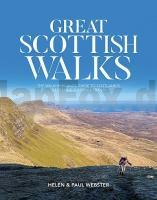
The walks are illustrated with stunning photography, showcasing the incredibly varied Scottish mainland and island landscapes that you can discover, from remote mountains and glens, coastal sea stacks and beaches, to the lush farmland and canals of the lowlands. There are countless towns, villages and historical sites that you`ll want to stop and visit along the way, rich in Scotland`s heritage and culture.

This book provides everything you need to inspire you to explore further, including an overview of what to expect from each route, logistical information about tackling the routes over a number of days, overview mapping, and practical information about access, public transport, accommodation and local amenities. With Great Scottish Walks, let Helen and Paul equip you to take on your own long-distance adventure and discover the amazing trails that Scotland has to offer.

Kartenbeispiel

Great Scottish Walks The Walkhighlands guide to Scotland`s best longdistance trails - Vertebrate Publishing
EAN / ISBN: 9781839812095
Preis: EUR 27.90

Bestellartikel: versandfertig in ca. 3-7 Tagen. Dieser Artikel wird speziell für Sie bestellt. Keine Rücknahme!
Produkt EUR Anzahl Bestellen
Great Scottish Walks The Walkhighlands guide to Scotland`s best longdistance trails - Vertebrate Publishing 27.90
Versandkostenfrei in Deutschland ab 30,- Bestellwert

incl. MwSt.

Stichworte, die bei der Suche nützlich sein könnten:
Schottland Wanderführer - Rob Roy Way - Clyde Walkway - Moray Coast Trail - Berwickshire Coastel Path - Hebridean Way - Southern Upland Way - Three Lochs Way - Schottland - Schottland Landkartenverkauf - Schottland Atlanten - Schottland Kartographie - Schottland Wanderkarten - Schottland Radwanderkarten - Schottland Kartografie - Schottland Fahrradkarten - Schottland Reiseführer - Schottland Radwanderführer - Schottlandkarten - Schottland Landkarten - Schottland Karten - Schottland Straßenkarten - Großbritannien - Großbritannien Wanderführer - Großbritannien Trekkingführer - Großbritannien Klettern - Großbritannien Kletterführer - Vertebrate Reiseführer - Vertebrate Publishing - Wanderführer Großbtitannien - Wanderführer Schottland - Radwanderführer Großbritannien

Zuletzt angesehene Artikel:

CoverGreat Scottish Walks The Walkhighlands guide to Scotland`s best longdistance trails - Vertebrate Publishing

CoverL4234 Hikiä Topographische Karte 1:25.000 EUREF (Peruskartta) Maanmittauslaitos / Lantmäteriverket Finnland - ProjektNord

Cover6733 Allersberg Topographische Landkarte Bayern 1:25.000 - Normalausgabe - ProjektNord (geplottete Ausgabe) - Grundlage amtliche Topographische Karte Bayern DTK25

CoverFalk Stadtplan Extra Standardfaltung Aachen mit Cityplänen von Stolberg und Würselen Mit Cityplänen von Stolberg und Würselen

CoverL6132 Scheßlitz (geplottete Ausgabe) Topographische Karte Bayern 1:50.000 Bayerisches Landesvermessungsamt

CoverDUMONT Reise-Taschenbuch Salzburg Stadt - Land - Salzkammergut von Weiss, Walter M. DuMont Reise-Taschenbuch

CoverM4144 Vesijako Topographische Karte 1:25.000 EUREF (Peruskartta) Maanmittauslaitos / Lantmäteriverket Finnland - ProjektNord

Noch kein Cover vorhanden2757 Zachan Topographische Karte 1:25.000 Messtischblatt des Deutschen Reiches - Preußische Landesaufnahme / Reichsamt für Landesaufnahme - Faksimile ProjektNord

Noch kein Cover vorhanden5073 Carlsruhe i. Ob. Schles. Topographische Karte 1:25.000 Messtischblatt des Deutschen Reiches - Preußische Landesaufnahme / Reichsamt für Landesaufnahme - Faksimile ProjektNord

Cover03-432 Topographische Karte 1:25.000 der Tschechischen Republik
Zakladní mapa Ceská republika Cesky urad zememericky a katastralni - ProjektNord

Cover34 Topographische Landkarte Wanderkarte und Fahrradkarte Portugal 1:25.000
034 Mapa topográfico - Mapa de caminhadas - Portugal 1:25.000 ProjektNord

CoverMatra Atlas 1:40.000 Wanderatlas Ungarn (ungarisch) - Cartographia

Noch kein Cover vorhanden3342-SW Topographische Karte 1:10.000 - Landesvermessungsamt Brandenburg

Cover6229 Schlüsselfeld Topographische Landkarte Bayern 1:25.000 - Normalausgabe - ProjektNord (geplottete Ausgabe) - Grundlage amtliche Topographische Karte Bayern DTK25

Cover0470-1 BATEA Topographische Landkarte 1:25.000 Spanien (Grundlage MTN25) Instituto Geográfico Nacional - CNIG Spanien - ProjektNord

CoverM4132 Hauho Topographische Karte 1:25.000 EUREF (Peruskartta) Maanmittauslaitos / Lantmäteriverket Finnland - ProjektNord

CoverV4322 Topographische Karte 1:25.000 EUREF (Peruskartta) Maanmittauslaitos / Lantmäteriverket Finnland - ProjektNord

CoverN3324 Isojoki Topographische Karte 1:25.000 EUREF (Peruskartta) Maanmittauslaitos / Lantmäteriverket Finnland - ProjektNord

CoverQeqertarsuaq / Disko Insel / Disko Ø (Blatt 11) 1:250.000 Topographische Landkarte Westgrönland Saga Maps

CoverV4342 Näätäselkä Topographische Karte 1:25.000 EUREF (Peruskartta) Maanmittauslaitos / Lantmäteriverket Finnland - ProjektNord