Willkommen bei MapFox
Wurde Ihre Bestellung bestätigt? Wenn nicht - gab es evtl. ein SERVER-Problem! Bitte kontaktieren Sie uns! +++ Buchhändler-Anfragen erwünscht +++
Warenkorb
Artikel: 0 - € 0.00
Zur Kasse
Impressum Kontakt Versandkosten AGB
Walking the King Charles III England Coast Path: North West - Cumbria Map Booklet 1:25.000 OS Route Map Booklet - von Harker, Ange - Cicerone Press Limited
<< Großbritannien: Wanderführer + Kletterführer
<< Cicerone
 
Cover


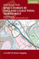
This map booklet to the Cumbrian section of the England Coast Path contains detailed mapping for walking the route in either direction. With easy access at many points along the way, the Cumbrian section can be enjoyed as a trek of around 15 days or in shorter sections.


Full route shown on 1:25.000 OS maps

Map booklet can be used to walk the path in either direction

Covers the England Coast Path from Gretna on the Scottish border to Arnside

Conveniently sized for slipping into a jacket pocket or top of a rucksack

An accompanying Cicerone guidebook - Walking the England Coast Path: North West - is available separately

Walking the King Charles III England Coast Path: North West - Cumbria Map Booklet 1:25.000 OS Route Map Booklet - von Harker, Ange - Cicerone Press Limited
EAN / ISBN: 9781786310293
Preis: EUR 19.90

Bestellartikel: versandfertig in ca. 1-3 Wochen. Dieser Artikel wird speziell für Sie bestellt. Keine Rücknahme!
Produkt EUR Anzahl Bestellen
Walking the King Charles III England Coast Path: North West - Cumbria Map Booklet 1:25.000 OS Route Map Booklet - von Harker, Ange - Cicerone Press Limited 19.90
Versandkostenfrei in Deutschland ab 30,- Bestellwert

incl. MwSt.

Stichworte, die bei der Suche nützlich sein könnten:
Cicerone - Cicerone Radwanderführer - Cicerone Wanderführer - Großbritannien Radwanderführer - Großbritannien Wanderführer - Cicerone Großbritannien - Großbritannien - Großbritannien Wanderführer - Großbritannien Trekkingführer - Großbritannien Klettern - Großbritannien Kletterführer

Zuletzt angesehene Artikel:

CoverWalking the King Charles III England Coast Path: North West - Cumbria Map Booklet 1:25.000 OS Route Map Booklet - von Harker, Ange - Cicerone Press Limited

CoverCycling Lôn Las Cymru 250 miles through the heart of Wales Radwanderführer - Cicerone (englisch)

CoverThe Isle of Man - 40 walks exploring the entire island - A walker`s guide Wanderführer Cicerone Großbritannien (englisch)

CoverKingdom of Fife - 40 Coast & Country Walks Dan Bailey - Pocket Mountains POCKET MOUNTAINS LTD

CoverBündner Alpen Band 5 Bernina-Massiv und Valposchiavo Alpinführer Schweizer Alpen Schweizer Alpen-Club

CoverHawaii 1:200.000 / 1:400.000 Straßenkarte Borch laminiert
Hawaiian Islands

CoverVal Calanca 24 Wanderungen im Süden Graubündens von Silvia Fantacci und Ueli Hintermeister - Rotpunktverlag

CoverWalking in County Durham - 40 walking routes exploring Pennine moors, river valleys and coastal paths - walking guide Wanderführer - Cicerone Großbritannien (englisch)

CoverKletterführer Berner Jura - Biel - Moutier (franz./dt.) Schweizer Alpen-Club

CoverWanderführer Alpinwandern in den Voralpen - zwischen Saane und Reuss Schweizer Alpen-Club

CoverWalking The West Highland Way - Scottish Great Trail - from Milngavie (Glasgow) to Fort William - Wanderführer (englisch)
A Cicerone Guide

Cover15 Short Walks in the Peak District - Edale and the Hope Valley - von McCloy, Andrew - Cicerone Press Limited

Cover6 Wales / Cymru and West Midlands 1:250.000 Travel Map Road - Straßenkarte Großbritannien - Ordnance Survey

CoverPaddy Buckley Round (Wales) Wanderkarte 1:40.000 (wasserfest) HARVEY MAPS
Paddy Buckley Round Map - Snowdonia - (waterproof)

CoverWales Coast Path 1 - Chester to Caernarfon 1:40 000 National Trail - HARVEY MAPS
Wales Coast Path 1 - National Trail Map

CoverWales Coast Path 3 - Cardigan to Llanelli - including Pembrokeshire Coast Path National Trail - HARVEY MAPS
Wales Coast Path 3 - National Trail Map

CoverWales Coast Path 4: Llanelli to Chepstow - Including Gower Peninsula 1:40 000 National Trail - HARVEY MAPS
Wales Coast Path 4 - National Trail Map

Cover1325 SEMBRANCHER 1:25.000 - Martigny - Catogne - Verbier - Topographische Landeskarte der Schweiz - swisstopo

CoverVal de Ruz - Montagnes 1:25.000 - Pays de Neuchâtel - TopoRando Topographische Wanderkarte edition mpa by Orell Füssli - Schweiz

CoverWales Coast Path 2 - Caernarfon to Cardigan - including Llyn Peninsula 1:40 000 National Trail - HARVEY MAPS
Wales Coast Path 2 - National Trail Map