 Confidently explore the Isle of Wight’s amazing variety of beautiful and varied scenery with Martin Simons’ 40 fully detailed walking routes suitable for a wide range of ages and fitness levels.
Each route’s itinerary includes: - walking route summary. - ratings for Effort, Time, Distance, Ascents/Descents, Refreshments and Vertigo risk. - access details for bus and car users. - fully detailed walk description, including frequent timings to aid navigation and check your progress. - GPS Waypoints at every key point on every route for pin-point navigational accuracy. - full colour OS map of each walk with the route and waypoints highlighted. - short walk and stroll alternatives.
Routes are linked to the Southern Vectis bus services with a ?bus return’ on the linear walking routes.
With Martin`s excellent walk descriptions you`ll know which routes are for you - and all of them are a true adventure Packed into an island just 23 miles by 13 miles the Isle of Wight offers impressive hills, towering cliffs, river valleys, marshes, rich farmland, a variety of woodlands, prehistoric burial mounds, ancient churches, attractive villages, and a wealth of inns and pubs. Criss-crossed by over 500 miles of footpaths and bridleways, plus paths across access land, it also boasts nature reserves, forests, and the most spectacular beaches in the south of England.
You can discover all of these with Martin Simons’ Walk! the Isle of Wight.  Kartenausschnitt Kartenausschnitt
Kartenbeispiel
|
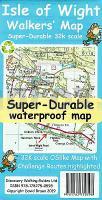
Isle of Wight 1:32.000 Wanderkarte - Discovery Walking Guides Ltd
EAN / ISBN: 9781782750598
Preis: EUR 11.90
|
|


