| << GroÃbritannien: Wanderkarten, Radwanderkarten und MTB-Karten << Geographers A-Z |
||
|
||
Zuletzt angesehene Artikel:
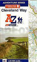
 | Cleveland Way A-Z Adventure Atlas Map 1:25.000 Wanderkarte Geographers` A-Z GroÃbritannien |
 | Spanien - Portugal 1:800.000 Landkarte - Kümmerly & Frey |
 | Stolpmünde - Stadtplan 1:5.000 Cartomedia - Sygnatura Polen USTKA plan miasta |
 | Osttirol Süd: Lienz - Drautal - Villgraten - Lesachtal - Rother Wanderführer - Bergverlag Rother |
 | Panama Reiseführer (englisch) - von Carolyn McCarthy - Lonely Planet |
 | Stefan Loose Travel Handbücher Kuba von Krüger, Dirk |
 | 184 Colchester - Wanderkarte GroÃbritannien 1:25.000 EXPLORER MAP - Active Map LAMINIERT - Ordnance Survey |
 | Walking The North Downs Way - Wanderführer (englisch) National Trail from Farnham to Dover - Cicerone Guide by Kev Reynolds |
 | DUMONT Reise-Taschenbuch Kärnten von Weiss, Walter M. |
 | Majella Parco Nazionale Wanderführer (italienisch) SOCIETA EDITRICE RICERCHE (SER) - Italien |
 | 193 Luton & Stevenage - Wanderkarte GroÃbritannien 1:25.000 EXPLORER MAP - Ordnance Survey |
 | Glyndwr`s Way - A national Trail through mid-Wales Wanderführer - Cicerone (englisch) |
 | Bahnradweg Hessen 1:50.000 bikeline Radwanderführer - Esterbauer |
 | 426 Banff - Macduff & Turriff - Wanderkarte GroÃbritannien 1:25.000 EXPLORER MAP - Ordnance Survey |
 | MARCO POLO Karten 1:225.000 Schweiz - Ãstlicher Teil |
 | Tokyo CityTrip Reiseführer mit Faltplan - von Oliver Hoffmann und Kikue Ryuno - Reise Know-How |
 | Baltic countries Road map StraÃenkarte Baltikum 1:700.000 Jana Seta |
 | Walking in the Dolomites 25 multi-day routes - Wanderführer - Cicerone (englisch) |
 | Guatemala Reiseführer (englisch) - von Lucas Vidgen, Daniel C. Schechter Lonely Planet |
 | 123.31 Amtliche topographische Karte 1:25.000 Polen |