 SC5 & SC6 : Garden Route / Baviaanskloof The Cape to Addo map series covers the southern parts of the Western Cape of South Africa in a series of eight highly detailed maps, printed on four sheets of A1 durable paper. We start in Cape Town in the west and move along the southern coast through the Overberg, Winelands, Garden Route, Klein Karoo R62, Baviaanskloof to eventually arrive in the Addo National Park up to Gqeberha (Port Elizabeth) in the east. The maps are highly detailed and well researched. Our map scale is 1:200 000 which allows us to show a lot of detail including minor gravel roads, hiking trails, farm boundaries and points of interest which are relevant to self-drive tourists. The size of the paper is kept small enough to allow this to be the perfect road tripping map. We use Duraflex paper and print two maps per sheet of A1 paper, making this a four-sheet series. Each map sheet is individually packed in a plastic protective sleeve. The maps are perfect for day drives, overlanding or just doing road trips in your sedan, 4WD or motorbike along our beautiful southern coast, Klein Karoo and parts of the proper Karoo. Mountain passes form a prominent feature in this area, and these are indicated together with scenic route options. As with other Tracks4Africa maps, these maps include drive times over and above driving distances. Adventure bikers will be pleased to know that minor gravel roads are included together with various accommodation options. The map has a relief background onto which farm boundaries, protected areas and other geographical features are shown. For each town we indicate what basic services are offered, e.g. fuel, shops, camping accommodation. We also show the facilities and activities of the various nature reserves. These two Maps - the SC5 & SC6 : George to Kareedouw, are dominated by the famous Garden Route, but it also includes lesser-known counterparts like the Langkloof Valley and the Baviaanskloof wilderness area, which is popular with adventure seekers on foot, MTB, adventure bike and 4WD. The map covers an area from the Karoo to coast which makes for some very diverse landscapes and stunning mountain passes. The coastline between George and Plettenberg Bay has some of the most stunning beaches in South Africa and the Indian Ocean ensures that it is much warmer to swim here than further west. Expect lush green forest areas and deep valleys along the Garden Route between George and Storms River Mouth. Drive the famous Seven Passes Road between George and Knysna to experience a true forest meander, built by Thomas Bain. The Otter Hiking trail is possibly one of our most famous multi day hikes between Storms River Mouth and Nature’s Valley. The Garden Route is packed with offerings to tourists. The famous Knysna lagoon and heads can be explored by boat cruise or get your adrenalin fix with the world’s highest bridge bungy jump at Bloukrans bridge near Nature’s valley. You have not camped until you pitched your tent at either Ebb & Flow in Wilderness or right in front of the massive waves at Storms River Mouth. As the name suggests, these two maps, printed on either side of a single sheet of Duraflex paper, stretch from George in the west to Kareedouw in the east. The coastline forms the southern boundary and to the north it includes places like Klaarstroom, Willowmore and Steytlerville which are in the Karoo. - Key areas of interest include the Garden Route between George and Storms River Mouth, Baviaanskloof wilderness area, Langkloof Valley and parts of the Klein Karoo. - Prominent towns include George, Knysna, Willowmore, Uniondale, Wilderness, Plettenberg Bay, Storms River, Steytlerville and Kareedouw.  Kartenausschnitt Kartenausschnitt
Kartenbeispiel
|
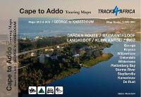
George to Kareedouw maps SC5 & SC6 1:200.000 Cape to Addo Touring Maps - Tracks4Africa
EAN / ISBN: 9781776322763
Preis: EUR 26.90
|
| 


