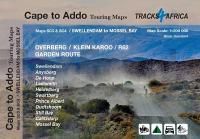
 SC3 & SC4 : Overberg, Klein Karoo along the R62, part of the Garden Route The Cape to Addo map series covers the southern parts of the Western Cape of South Africa in a series of eight highly detailed maps, printed on four sheets of A1 durable paper. We start in Cape Town in the west and move along the southern coast through the Overberg, Winelands, Garden Route, Klein Karoo R62, Baviaanskloof to eventually arrive in the Addo National Park up to Gqeberha (Port Elizabeth) in the east. The maps are highly detailed and well researched. Our map scale is 1:200 000 which allows us to show a lot of detail including minor gravel roads, hiking trails, farm boundaries and points of interest which are relevant to self-drive tourists. The size of the paper is kept small enough to allow this to be the perfect road tripping map. We use Duraflex paper and print two maps per sheet of A1 paper, making this a four-sheet series. Each map sheet is individually packed in a plastic protective sleeve. The maps are perfect for day drives, overlanding or just doing road trips in your sedan, 4WD or motorbike along our beautiful southern coast, Klein Karoo and parts of the proper Karoo. Mountain passes form a prominent feature in this area, and these are indicated together with scenic route options. As with other Tracks4Africa maps, these maps include drive times over and above driving distances. Adventure bikers will be pleased to know that minor gravel roads are included together with various accommodation options. The map has a relief background onto which farm boundaries, protected areas and other geographical features are shown. For each town we indicate what basic services are offered, e.g. fuel, shops, camping accommodation. We also show the facilities and activities of the various nature reserves. This Map - the SC3 & SC4 : Swellendam to Mossel Bay cover an area which can be described as road trip heaven. You can meander this area on a road bike, an adventure bike, a mountain bike, a normal car, 4WD or do the camper van thing. There is literally something for everyone’s taste. Once you enter the R62 beyond Montagu you immediately experience the relaxed nature of the Klein Karoo and the towns along the R62 will compete for your custom in the form of coffee shops, restaurants and curio shops as well as farm stalls. There are plenty of accommodation options included on the map and you will find something for every budget. This area may not boast the world-famous attractions of Cape Town and surrounds; however, it has hidden gems and stunning scenery. Try out whale watching at De Hoop nature reserve, ride the adventurous gravel roads over the Swartberg mountains and down into the The Hell, explore the Cango Caves outside Oudtshoorn, experience the mildest climate in the world in Mossel Bay or string together a back road trip with all the scenic routes indicated on the map. It is an area that will rejuvenate your soul. As the name suggests, these two maps, printed on either side of a single sheet of Duraflex paper, stretch from Swellendam in the west to Mossel Bay and Oudtshoorn in the east. The coastline forms the southern boundary and to the north it includes places like Anysberg reserve, parts of the N1 highway and Prince Albert town. - Key areas of interest include the Overberg region, the Klein Karoo along the famous R62, the Garden Route including protected areas such as De Hoop and Swartberg Nature Reserves. - Prominent towns include Swellendam, Barrydale, Ladismith, Heidelberg, Prince Albert, Oudtshoorn, Still Bay, Calitzdorp and Mossel Bay.  Kartenausschnitt Kartenausschnitt
Kartenbeispiel
|
Swellendam to Mossel Bay maps SC3 & SC4 1:200.000 Cape to Addo Touring Maps - Tracks4Africa
EAN / ISBN: 9781776322756
Preis: EUR 26.90
|
| 


