Willkommen bei MapFox
+++ Buchhändleranfragen willkommen! Tel. 0431-666 75 99 +++
Warenkorb
Artikel: 0 - € 0.00
Zur Kasse
Impressum Kontakt Versandkosten AGB
Zimbabwe GPS-Tracks Touristenkarte 1:1 Mio. (engl.) Tracks4Africa
<< Simbabwe
<< Tracks4Africa
 
Cover

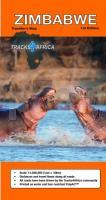
Zimbabwe has been the overlanding jewel of Southern Africa for decades and we do not know why it took us so long to get to a dedicated paper map for this popular destination. Now you can plan your overlanding trip to Zimbabwe with a high detail map indicating places of interest, national parks, towns with services and all the roads connecting them. As with our other maps in the country map series, Zimbabwe paper map also features time and distance indicators on roads which allows for easy trip planning.

Kartenbeispiel

Zimbabwe GPS-Tracks Touristenkarte 1:1 Mio. (engl.) Tracks4Africa
EAN / ISBN: 9781776322732
Preis: EUR 25.90

Bestellartikel: versandfertig in ca. 3-7 Tagen. Dieser Artikel wird speziell für Sie bestellt. Keine Rücknahme!
Produkt EUR Anzahl Bestellen
Zimbabwe GPS-Tracks Touristenkarte 1:1 Mio. (engl.) Tracks4Africa 25.90
Versandkostenfrei in Deutschland

incl. MwSt.

Stichworte, die bei der Suche nützlich sein könnten:
Zimbabwe - Simbabwe - Simbabwe - Simbabwe Atlanten - Simbabwe Kartografie - Simbabwe Straßenkarten - Simbabwe Landkartenverkauf - Simbabwe Fahrradkarten - Simbabwe Landkarten - Simbabwe Wanderkarten - Simbabwe Radwanderführer - Simbabwekarten - Simbabwe Reiseführer - Simbabwe Kartographie - Simbabwe Karten - Simbabwe Radwanderkarten - Afrika - Tracks4Africa - Afrika Landkarte - Afrikakarten - Namibia Landkarten - Botswana Landkarten - Südafrika Landkartee

Zuletzt angesehene Artikel:

CoverZimbabwe GPS-Tracks Touristenkarte 1:1 Mio. (engl.) Tracks4Africa

CoverTödi (Blatt 12) 1:50.000 Topographische Skitourenkarte der Schweiz - SNOW TRAIL MAP

Noch kein Cover vorhanden2227SB La Châtre - Neuvy - Saint-Sépulchre GPS Amtliche Topographische Wanderkarte Frankreich 1:25.000 - série bleue (IGN)

Noch kein Cover vorhandenBend / Redmond / Madras / Princeville / Sisters Stadtplan 1:32.000 (Ohio - USA)
Bend / Redmond / Madras / Princeville / Sisters street map GM Johnson

Cover2117 Cuxhaven West Topographische Wanderkarte 1:25.000 Niedersachsen mit Wanderwegen - ProjektNord

Noch kein Cover vorhanden5979 Kobier Topographische Karte 1:25.000 Messtischblatt des Deutschen Reiches - Preußische Landesaufnahme / Reichsamt für Landesaufnahme - Faksimile ProjektNord

Cover106K04 Topographische Landkarte 1:50.000 - Canada - Yukon Territory / North West Territories

Cover3535OTR NEVACHE / MONT THABOR - Cols du Galibier et du Lautaret - Topographische Wanderkarte Frankreich 1:25.000 (LAMINIERTE AUSGABE) TOP 25 IGN - (GPS)

Noch kein Cover vorhanden2518 SB Lorrez-le-Bocage-Préaux - Chéroy - St-Valérien Amtliche Topographische Wanderkarte Frankreich 1:25.000 - série bleue (IGN)

CoverBaja California North - GPS 1:450.000 (Blatt 3103) Landkarte - Adventure Map (Blatt 3103) - National Geographic - Mexiko

Noch kein Cover vorhanden2345SB Carcassonne - Alzonne GPS Amtliche Topographische Wanderkarte Frankreich 1:25.000 - série bleue (IGN)

CoverCotswold Classic Walks Walking-Guidebook (engl.) Goldeneye Publications - Großbritannien

Noch kein Cover vorhandenM-34-1-A/B Stawiszyn Amtliche topographische Landkarte Polen 1:50.000
M-34-1-A/B Stawiszyn - Mapa Topograficzna Polski Glowny Geodeta Kraju

CoverM3243 Mäntyluoto Topographische Karte 1:25.000 EUREF (Peruskartta) Maanmittauslaitos / Lantmäteriverket Finnland - ProjektNord

CoverN34 Topographische Karte 1:100.000 EUREF-FIN Maanmittauslaitos / Lantmäteriverket Finnland - ProjektNord

Noch kein Cover vorhanden1925 E PREUILLY SUR CLAISE GPS Amtliche Topographische Wanderkarte Frankreich 1:25.000 - série bleue (IGN)

Cover15-43 Ostrava Topographische Karte 1:50.000 der Tschechischen Republik
Zakladní mapa Ceská republika - Cesky urad zememericky a katastralni - ProjektNord

Noch kein Cover vorhanden0192 Nimmersatt Topographische Karte 1:25.000 Messtischblatt des Deutschen Reiches - Preußische Landesaufnahme / Reichsamt für Landesaufnahme - Faksimile ProjektNord

CoverEisenburg (Torockó / Rimetea) und Umgebung 1:25.000 Wanderkarte (mehrsprachig)
Torockó es vidéke / Torockó - Rimetea and surroundings tourist map Schwarcz Térkép

CoverNS533 Buddha Himal Himalchuli - Great Lakes Trail 1:125.000 Trekkingkarte - Himalayan MapHouse - Nepal