Willkommen bei MapFox
Wurde Ihre Bestellung bestätigt? Wenn nicht - gab es evtl. ein SERVER-Problem! Bitte kontaktieren Sie uns! +++ Buchhändler-Anfragen erwünscht +++
Warenkorb
Artikel: 0 - € 0.00
Zur Kasse
Impressum Kontakt Versandkosten AGB
WILD ATLANTIC WAY ROUTE Atlas County Clare Xploreit 1:80.000 XPLOREIT MAPS
<< Xploreit Maps - Irland
<< Irland: Wanderkarten verschiedener Verlage
 
Cover

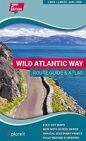
The Wild Atlantic Way is the world’s longest defined coastal route. It includes Ireland’s most northerly point, Malin Head, in Donegal and it’s most southerly point, Mizen Head in Cork. All along the way you will find a myriad of spectacular discovery points with incredible scenic views.

This atlas splits up the route into 30 foldout maps that are detailed yet easy to read. The coastal roads are classified so that you are instantly aware of any narrow sections and you can also see where the really scenic stretches are located. Each section is drivable in one day or less and there are useful distance charts for towns and villages to help you plan your journey.

All of the official Discovery Points are clearly shown including the 15 iconic Signature Points. Over 40 different categories of visitor information are shown to help you locate numerous hidden gems and well-known attractions. A variety of coastal and forest walks in the vicinity of the route are detailed.

Main Features:

  • 30 Fold-Out road maps showing the route and road types
  • Route Planning maps
  • Gazetteer of Discovery Points with GPS coordinates and brief descriptions
  • Distance Charts for towns and villages
  • Scenic sections highlighted
  • Ferry departure points
  • Wide range of other visitor attractions and points of interest shown
  • Map legend in English, German and French
  • Map Scale 2 miles to 1 inch - 1:126,720
  • Kartenausschnitt

    Kartenbeispiel

    WILD ATLANTIC WAY ROUTE Atlas County Clare Xploreit 1:80.000 XPLOREIT MAPS
    EAN / ISBN: 9780955265594
    Preis: EUR 26.90

Bestellartikel: versandfertig in ca. 3-7 Tagen. Dieser Artikel wird speziell für Sie bestellt. Keine Rücknahme!
Produkt EUR Anzahl Bestellen
WILD ATLANTIC WAY ROUTE Atlas County Clare Xploreit 1:80.000 XPLOREIT MAPS 26.90
Versandkostenfrei in Deutschland ab 30,- Bestellwert

incl. MwSt.

Stichworte, die bei der Suche nützlich sein könnten:
Irland Wanderkarte - Irland Landkarte - Ireland Landkarte - Irland Wanderatlas - Xploreit - Irland - Irland Wanderkarten - Irland Straßenkarten - Irland Landkarten - Irische Landkarten - Ireland maps - Irland Landkarten - Ireland hiking maps - Irlandkarten

Zuletzt angesehene Artikel:

CoverWILD ATLANTIC WAY ROUTE Atlas County Clare Xploreit 1:80.000 XPLOREIT MAPS

Cover7441 Frontenhausen Topographische Landkarte Bayern 1:25.000 - Normalausgabe - ProjektNord (geplottete Ausgabe) - Grundlage amtliche Topographische Karte Bayern DTK25

Noch kein Cover vorhanden163.3 Amtliche topographische Karte 1:50.000 Polen

CoverBuenos Aires pocket guide Reiseführer (engl.) Lonely Planet

Noch kein Cover vorhanden141 N Svartisen NORD 1:50.000 - Amtliche Topographische Landkarte Norwegen - Startens Kartverk

Noch kein Cover vorhanden117 S Halten SØR 1:50.000 - Amtliche Topographische Landkarte Norwegen - Startens Kartverk

Cover13B BELLINGWOLDE Topographische Karte der Niederlande 1:25.000 (Plotausgabe)
13B BELLINGWOLDE Topografische Kaart van Nederland Kadaster - ProjektNord

Noch kein Cover vorhandenIrkutsk - Südliches Baikalsee-Umland - Taschenatlas 1:200.000 / 1:25.000 Russland
Irkutsk / Juzhnoe Pribajkale Atlas karmannyj Irkutskaya Kartografitscheskaya Fabrika (Russland) - VostSib AGP

Noch kein Cover vorhanden187 S Porsangmoen SØR 1:50.000 - Amtliche Topographische Landkarte Norwegen - Startens Kartverk

Noch kein Cover vorhanden522.1 Amtliche topographische Karte 1:50.000 Polen

Noch kein Cover vorhanden1967 Rummelsburg Topographische Karte 1:25.000 Messtischblatt des Deutschen Reiches - Preußische Landesaufnahme / Reichsamt für Landesaufnahme - Faksimile ProjektNord

CoverIrland Tourismuskarte 1:600.000
Visiting Ireland - Ordnance Survey

CoverCentral and Eastern Thailand 1:530.000 bilinguale Landkarte: Thai und Englisch - Thinknet - Thailand

Cover5125 Friedewald Topographische Landkarte Hessen 1:25.000 - ProjektNord (geplottete Ausgabe)

CoverP61 Topographische Karte 1:100.000 EUREF-FIN Maanmittauslaitos / Lantmäteriverket Finnland - ProjektNord

Cover189 Hereford & Ross-on-Wye - Wanderkarte Großbritannien 1:25.000 EXPLORER MAP - Active Map LAMINIERT - Ordnance Survey

Cover11-2 Karlovy Vary Topographische Karte 1:100.000 der Tschechischen Republik
Zakladní mapa Ceská republika - Cesky urad zememericky a katastralni - ProjektNord

Noch kein Cover vorhanden154.1 Amtliche topographische Karte 1:50.000 Polen

CoverBargusin-Tal - Baikalsee Touristische topographische Landkarte 1:150.000 / 1:900.000 - Russland / Mongolei
Баргузинская долина - Озеро Байкал FGUP Vostočno sibirskoe aerogeodezičekoe predprijatie

Cover15D SPAANDERBANK Topographische Karte der Niederlande 1:25.000 (Plotausgabe)
15D SPAANDERBANK Topografische Kaart van Nederland Kadaster - ProjektNord