 - Easy-to-follow directions
- Clear waypointed maps
- Colour-coded routes - pick from easy strolls through to more challenging walks
- Fascinating background reading for every walk
- Advice for dog owners
- Great for a full day out with recommended sights and attractions plus places to eat and drink  Kartenausschnitt Kartenausschnitt
Kartenbeispiel
|
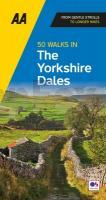
50 Wanderrouten in den Yorkshire Dales Wanderführer - AA Automobile Association / OS Ordnance Survey - Großbritannien
50 walks in the Yorkshire Dales - walking guide
EAN / ISBN: 9780749583309
Preis: EUR 19.90
|
| 


