| << Schweden: Landkarten auf CD-ROM und DVD |
||
|
||
Zuletzt angesehene Artikel:
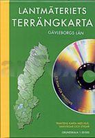
 | Gävleborgs län Terräng CD (3) Topographische Landkarte Schweden 1:50.000 auf CD-ROM Kartförlaget Schweden |
 | P3424 Jöusan Topographische Karte 1:25.000 EUREF (Peruskartta) Maanmittauslaitos / Lantmäteriverket Finnland - ProjektNord |
 | U5241 Topographische Karte 1:25.000 EUREF (Peruskartta) Maanmittauslaitos / Lantmäteriverket Finnland - ProjektNord |
 | L3534 Hansestadt Gardelegen Topographische Karte 1:50.000 Landesamt für Vermessung und Geoinformation Sachsen-Anhalt (Landesvermessungsamt) |
 | Region Hamburg 1:200.000 Topographische StraÃenkarte ProjektNord - Bundesamt f. Kartographie u. Geodäsie |
 | L3231 à va Topographische Karte 1:25.000 EUREF (Peruskartta) Maanmittauslaitos / Lantmäteriverket Finnland - ProjektNord |
 | Nuorgam - Näätämöjoki - Sevettijärvi 1:50.000 Topographische Wanderkarte - Outdoor map - Genimap / Karttakeskus - Finnland |
 | Mit dem Wohnmobil durch die Türkei (Band 82) Teil 2: Die Mitte - Wohnmobil, Camping, Reisen, Urlaub - von Nicola Kluftinger und Stephanie Seufert - Womo |
 | T5132 Jumisko Topographische Karte 1:25.000 EUREF (Peruskartta) Maanmittauslaitos / Lantmäteriverket Finnland - ProjektNord |
 | U5231 Martti Topographische Karte 1:25.000 EUREF (Peruskartta) Maanmittauslaitos / Lantmäteriverket Finnland - ProjektNord |
 | 4538 Halle (Saale) Ost Topographische Karte 1:25.000 Landesamt für Vermessung und Geoinformation Sachsen-Anhalt (Landesvermessungsamt) |
 | 624 Uddheden - Terrängkartan 1:50.000 Topographische Wanderkarte Schweden - Lantmäteriet Landkarte Schweden |
 | P4442 Koivujärvi Topographische Karte 1:25.000 EUREF (Peruskartta) Maanmittauslaitos / Lantmäteriverket Finnland - ProjektNord |
 | U5243 Topographische Karte 1:25.000 EUREF (Peruskartta) Maanmittauslaitos / Lantmäteriverket Finnland - ProjektNord |
 | Cykelkartan Blad 22 Södermanland / Ãstergötland Fahrradkarte Schweden 1:90.000 - Norstedts |
 | P5114 Kuopio Topographische Karte 1:25.000 EUREF (Peruskartta) Maanmittauslaitos / Lantmäteriverket Finnland - ProjektNord |
 | U4311 Jääskö Topographische Karte 1:25.000 EUREF (Peruskartta) Maanmittauslaitos / Lantmäteriverket Finnland - ProjektNord |
 | S4344 Asmunti Topographische Karte 1:25.000 EUREF (Peruskartta) Maanmittauslaitos / Lantmäteriverket Finnland - ProjektNord |
 | U4234 Ylläs Topographische Karte 1:25.000 EUREF (Peruskartta) Maanmittauslaitos / Lantmäteriverket Finnland - ProjektNord |
 | 265T NUFENENPASS - Goms - Val Bedretto - Valle Maggia - Val Formazza (I) 1:50.000 Topographische Wanderkarte SAW der Schweiz - swisstopo |