| << Spitzbergen: Topographische Karten vom Nordisk Polarinstitut |
  | |
|
||
Zuletzt angesehene Artikel:
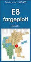
![]() | E8 Barentsjøkulen Spitzbergen / Svalbard / Spitsbergen - Topographische Karte 1:100.000 Norsk Polarinstitutt |
![]() | Neuchâtel et Nord vaudois / Neuenburg und Waadt Nord Kletterführer 2 sprachig - von Mironneau, C. Stern, C. Perrin, P.-D. Chevallier, A. Girardin, Ch - SAC-Verlag Schweizer Alpen-Club |
![]() | Fuerteventura - InselTrip - von Dieter Schulze - Reise Know-How |
![]() | Wasserstraßenkarte Frankreich 1:1 Mio. Alle schiffbaren und nicht-schiffbaren Flüsse und Kanäle in Frankreich CARTE DES VOIES NAVIGABLES DE FRANCE Édition du Breil |
![]() | 25G AMSTERDAM Topographische Karte der Niederlande 1:25.000 (Plotausgabe) 25G AMSTERDAM Topografische Kaart van Nederland Kadaster - ProjektNord |
![]() | 25E LANDSMEER Topographische Karte der Niederlande 1:25.000 (Plotausgabe) 25E LANDSMEER Topografische Kaart van Nederland Kadaster - ProjektNord |
![]() | 13 Scharhörn-West / Großer Vogelsand - Varendorfsche Karte 1789-1792 Topographisch Militärische Charte des Herzogtums Holstein - Reproduktion 1:25.000 |
![]() | 100 Orte in Ostbelgien & Umgebung - von Bernd Müllender - GEV - Grenz-Echo-Verlag Belgien |
![]() | 058 Perth & Alloa, Auchterarder - Wanderkarte Großbritannien 1:50.000 Active Laminiert LANDRANGER MAP - Ordnance Survey |
![]() | 12-24 Praha Topographische Karte 1:50.000 der Tschechischen Republik Zakladní mapa Ceská republika - Cesky urad zememericky a katastralni |
![]() | 271 Valderas Amtliche topographische Landkarte 1:50.000 Spanien (M.T.N.) 271 Mapa Topográfico Nacional de Espana (MTN50) Instituto Geográfico Nacional - CNIG Spanien |
![]() | München MM-City - Stadtführer Michael-Müller-Verlag - Reiseführer |
![]() | Spessart (Nr. 832) 2-teiliges Wanderkarten-Set 1:50.000 KOMPASS |
![]() | 1322SB Ancenis - Riaillé GPS Amtliche Topographische Wanderkarte Frankreich 1:25.000 - série bleue (IGN) |
![]() | Walking in Lancashire 40 Walks around the County - Wanderführer North West England - Cicerone Großbritannien (englisch) |
![]() | South Eastern Queensland (Blatt 431) Landkarte 1:500.000 - touring map - Queensland - Australien UBD Gregory`s Universal Publishers - Australien |
![]() | Rheinsteig einfach - Pocket-Wanderführer zum kleinen Preis Der günstige Pocketführer mit allen Infos zu 20 Rheinsteig-Etappen. - von Poller, Ulrike - Idee-Media |
![]() | 44H WAALWIJK Topographische Karte der Niederlande 1:25.000 (Plotausgabe) 44H WAALWIJK Topografische Kaart van Nederland Kadaster - ProjektNord |
![]() | N-34-74-C/D Kwidzyn Amtliche topographische Landkarte Polen 1:50.000 N-34-74-C/D Kwidzyn - Mapa Topograficzna Polski Glowny Geodeta Kraju |
![]() | 5232 Stadtilm Topographische Karte Thüringen 1:25.000 Landesvermessungsamt Thüringen |


