| << Portugal: Amtliche topografische Landkarten des Instituto Geográfico do Exército (IGeoE) 1:25.000 (Serie M888) |
||
|
||

Zuletzt angesehene Artikel:
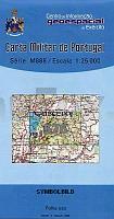
 | 576 Rogil (Aljezur) Topographische Landkarte Portugal 1:25.000 Carta Militar de Portugal - Série M888 Instituto Geográfico do Exército (IGeoE) - Portugal |
 | 931 Zarcilla de Ramos Amtliche topographische Landkarte 1:50.000 Spanien (M.T.N.) 931 Mapa Topográfico Nacional de Espana (MTN50) Instituto Geográfico Nacional - CNIG Spanien |
 | Seeländisch Flandern (Blatt 2) Fahrradkarte und Wanderkarte Belgien 1:50.000 Groen Zeeuws Vlaanderen - Meetjesland - Waasland - Rivierenland SPORTOENA |
 | 4112 Sendenhorst - Wanderkarte mit Wanderwegen (geplottete Ausgabe) ProjektNord - Grundlage Amtliche topographische Karte 1:25.000 Landesvermessungsamt Nordrhein-Westfalen |
 | 30/6 Ãtztaler Alpen - Wildspitze - Wege & Skitouren Wanderkarte / Skitourenkarte - Alpenvereinskarte Ãsterreich 1:25.000 - Deutscher Alpenverein |
 | 348 Marvao Topographische Landkarte Portugal 1:25.000 Carta Militar de Portugal - Série M888 Instituto Geográfico do Exército (IGeoE) - Portugal |
 | Mit dem Wohnmobil nach Mecklenburg-Vorpommern -Teil 1 (Band 87) Meckenburgische Seen - Wismarer Bucht - WOMO, Wohnmobil, Camping, Urlaub, Reise - von Stefanie Holtkamp - Womo Verlag |
 | Vegeriai (45-49/70-74) Topografische Karte Litauen 1:50.000 Lietuvos Respublikos Topografinis Zemelapis 1:50.000 - Nacionaline Zemes Tarnyba - Litauen |
 | 609-2 CHILLARÃN DE CUENCA Amtliche topographische Landkarte 1:25.000 Spanien (M.T.N.) 609-2 Mapa Topográfico Nacional de Espana (MTN25) Instituto Geográfico Nacional - CNIG Spanien |
 | 577 Malhada Quente (Monchique) Topographische Landkarte Portugal 1:25.000 Carta Militar de Portugal - Série M888 Instituto Geográfico do Exército (IGeoE) - Portugal |
| N-33-132-A/B Gniezno Amtliche topographische Landkarte Polen 1:50.000 N-33-132-A/B Gniezno - Mapa Topograficzna Polski Glowny Geodeta Kraju |
 | 2724 04 Kätkäsuvanto Topographische Karte 1:20.000 (Maastokartta / Peruskartta / Grundkarta) Maanmittauslaitos / Lantmäteriverket Finnland - ProjektNord |
| Tunguska (Amur) - Flusskarte 1:60.000 Reka Tunguska Karta-shema / Тунгуска (приток Амура) Dal`newostochnyj Federal`nyj Okrug - Russland |
 | 40 Viana do Castelo - Topographische Landkarte Portugal 1:25.000 Carta Militar de Portugal - Série M888 Instituto Geográfico do Exército (IGeoE) - Portugal |
 | 1334 05 Särkimo Topographische Karte 1:20.000 (Maastokartta / Peruskartta / Grundkarta) Maanmittauslaitos / Lantmäteriverket Finnland - ProjektNord |
 | 949 Amtliche topographische Landkarte 1:50.000 Spanien (M.T.N.) 949 Mapa Topográfico Nacional de Espana (MTN50) Instituto Geográfico Nacional - CNIG Spanien |
 | 3233 01 Juva Topographische Karte 1:20.000 (Maastokartta / Peruskartta / Grundkarta) Maanmittauslaitos / Lantmäteriverket Finnland - ProjektNord |
| 4668 Trebnitz in Niederschlesien Topographische Karte 1:25.000 Messtischblatt des Deutschen Reiches - PreuÃische Landesaufnahme / Reichsamt für Landesaufnahme - Faksimile ProjektNord |
 | Generalkarte des Baltenlandes (Estland - Kurland - Livland) 1:725.000 von Carl Flemming 1917 - Historische Landkarte Nachdruck POSTER 69 x 86 cm |
 | Dänemark Erlebnisrouten durch das Königreich zwischen Nord- und Ostsee - von Schabe, TobiasRoth, RosannaSchabe, Tobias - MOBIL & AKTIV ERLEBEN Wohnmobil Reiseführer |