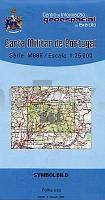
| << Portugal: Amtliche topografische Landkarten des Instituto Geográfico do Exército (IGeoE) 1:25.000 (Serie M888) |
||
|
||

Zuletzt angesehene Artikel:
 | 561 Odemira (Süd) Topographische Landkarte Portugal 1:25.000 Carta Militar de Portugal - Série M888 Instituto Geográfico do Exército (IGeoE) - Portugal |
 | Amalfi-Küste: Wanderkarte Nr. 2 - 24 Wanderungen von Minori nach Marina di Praia 1:10.000 (engl.) Touristische Wanderkarte Italien Cart&guide Amalfi Coast - map of the paths 2 -24 Walks from Minori to Marina di Praia Officine Zephiro - Italien |
 | 2633 07 Vammavaara Topographische Karte 1:20.000 (Maastokartta / Peruskartta / Grundkarta) Maanmittauslaitos / Lantmäteriverket Finnland - ProjektNord |
 | 2741 01 Ãkäsjärvi Topographische Karte 1:20.000 (Maastokartta / Peruskartta / Grundkarta) Maanmittauslaitos / Lantmäteriverket Finnland - ProjektNord |
 | 1060-I/III San José Amtliche topographische Landkarte 1:25.000 Spanien (M.T.N.) 1060-I/III Mapa Topográfico Nacional de Espana (MTN25) Instituto Geográfico Nacional - CNIG Spanien |
 | 2315-IV - mit Wanderwegen und Fahrradrouten Topographische Fahrradkarte und Wanderkarte Dänemark 1:50.000 - Kort & Matrikelstyrelsen ProjektNord 2315-IV - Topografisk Cykel- og Vandrekort Danmark |
 | 3512 06 Yli-Olhava Topographische Karte 1:20.000 (Maastokartta / Peruskartta / Grundkarta) Maanmittauslaitos / Lantmäteriverket Finnland - ProjektNord |
 | 3531 12 Tolpanlehto Topographische Karte 1:20.000 (Maastokartta / Peruskartta / Grundkarta) Maanmittauslaitos / Lantmäteriverket Finnland - ProjektNord |
 | 8335 Lenggries Topographische Landkarte Bayern 1:25.000 - Normalausgabe - ProjektNord (geplottete Ausgabe) - Grundlage amtliche Topographische Karte Bayern DTK25 |
 | 853 Burguillos del Cerro Amtliche topographische Landkarte 1:50.000 Spanien (M.T.N.) 853 Mapa Topográfico Nacional de Espana (MTN50) Instituto Geográfico Nacional - CNIG Spanien |
 | 532-1 NAVALPERAL DE PINARES Amtliche topographische Landkarte 1:25.000 Spanien (M.T.N.) 532-1 Mapa Topográfico Nacional de Espana (MTN25) Instituto Geográfico Nacional - CNIG Spanien |
 | 886-3 SORIHUELA DEL GUADALIMAR Amtliche topographische Landkarte 1:25.000 Spanien (M.T.N.) 886-3 Mapa Topográfico Nacional de Espana (MTN25) Instituto Geográfico Nacional - CNIG Spanien |
 | 2024 11 Salkola Topographische Karte 1:20.000 (Maastokartta / Peruskartta / Grundkarta) Maanmittauslaitos / Lantmäteriverket Finnland - ProjektNord |
 | 790 Albacete Amtliche topographische Landkarte 1:50.000 Spanien (M.T.N.) 790 Mapa Topográfico Nacional de Espana (MTN50) Instituto Geográfico Nacional - CNIG Spanien |
 | 2133 04 Hausjärvi Topographische Karte 1:20.000 (Maastokartta / Peruskartta / Grundkarta) Maanmittauslaitos / Lantmäteriverket Finnland - ProjektNord |
 | 6128 Ebrach Topographische Landkarte Bayern 1:25.000 - Normalausgabe - ProjektNord (geplottete Ausgabe) - Grundlage amtliche Topographische Karte Bayern DTK25 |
 | 907 (21-36) Villacarrillo Amtliche topographische Landkarte 1:50.000 Spanien (M.T.N.) 907 Mapa Topográfico Nacional de Espana (MTN50) Instituto Geográfico Nacional - CNIG Spanien |
 | 0933-3 ALHAMA DE MURCIA Topographische Landkarte 1:25.000 Spanien (Grundlage MTN25) Instituto Geográfico Nacional - CNIG Spanien - ProjektNord |
 | 792 Alpera Amtliche topographische Landkarte 1:50.000 Spanien (M.T.N.) 792 Mapa Topográfico Nacional de Espana (MTN50) Instituto Geográfico Nacional - CNIG Spanien |
 | 3633 08 Nuottivaara Topographische Karte 1:20.000 (Maastokartta / Peruskartta / Grundkarta) Maanmittauslaitos / Lantmäteriverket Finnland - ProjektNord |