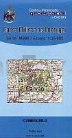
| << Portugal: Amtliche topografische Landkarten des Instituto Geográfico do Exército (IGeoE) 1:25.000 (Serie M888) |
||
|
||

Zuletzt angesehene Artikel:
 | 546 Garvao (Ourigue) - Topographische Landkarte Portugal 1:25.000 Carta Militar de Portugal - Série M888 Instituto Geográfico do Exército (IGeoE) - Portugal |
 | 933-2 ALCANTARILLA Amtliche topographische Landkarte 1:25.000 Spanien (M.T.N.) 933-2 Mapa Topográfico Nacional de Espana (MTN25) Instituto Geográfico Nacional - CNIG Spanien |
 | 2042 11 Kytäjä Topographische Karte 1:20.000 (Maastokartta / Peruskartta / Grundkarta) Maanmittauslaitos / Lantmäteriverket Finnland - ProjektNord |
 | 2212 01 Karvia Topographische Karte 1:20.000 (Maastokartta / Peruskartta / Grundkarta) Maanmittauslaitos / Lantmäteriverket Finnland - ProjektNord |
 | Vlasinasee 1:30.000 (serb./engl.) Touristische Landkarte Serbien - Kosovo - Vlasina lake tourist map - Geokarta D.O.O. Predeo izuzetnih odlika Vlasinsko jezero - Region of Exceptional Features |
 | 3324 10 Salahmi Topographische Karte 1:20.000 (Maastokartta / Peruskartta / Grundkarta) Maanmittauslaitos / Lantmäteriverket Finnland - ProjektNord |
 | 1067 Torremolinos Amtliche topographische Landkarte 1:50.000 Spanien (M.T.N.) 1067 Mapa Topográfico Nacional de Espana (MTN50) Instituto Geográfico Nacional - CNIG Spanien |
 | 2624 10+07 Väylänpää Topographische Karte 1:20.000 (Maastokartta / Peruskartta / Grundkarta) Maanmittauslaitos / Lantmäteriverket Finnland - ProjektNord |
 | 1034 12+15 Attu Topographische Karte 1:20.000 (Maastokartta / Peruskartta / Grundkarta) Maanmittauslaitos / Lantmäteriverket Finnland - ProjektNord |
 | 611-1 VALDEMORO-SIERRA Amtliche topographische Landkarte 1:25.000 Spanien (M.T.N.) 611-1 Mapa Topográfico Nacional de Espana (MTN25) Instituto Geográfico Nacional - CNIG Spanien |
 | 30-559 Eifelwandern 6 - Bütgenbach - Malmedy 1:25.000 - Höfen - Ligneuville - Malmedy - Monschau - Naturpark Hohes Venn - Robertville - Waimes - Wanderkarte mit Radwegen - NaturNavi |
 | 2311-II Bagenkop - mit Wanderwegen und Fahrradrouten Topographische Fahrradkarte und Wanderkarte Dänemark 1:50.000 - Kort & Matrikelstyrelsen ProjektNord 2311-II Bagenkop - Topografisk Cykel- og Vandrekort Danmark |
 | 6234 Pottenstein Topographische Landkarte Bayern 1:25.000 - Normalausgabe - ProjektNord (geplottete Ausgabe) - Grundlage amtliche Topographische Karte Bayern DTK25 |
 | 2834 04 Naukuselkä Topographische Karte 1:20.000 (Maastokartta / Peruskartta / Grundkarta) Maanmittauslaitos / Lantmäteriverket Finnland - ProjektNord |
 | 2642 09 Juusovaara Topographische Karte 1:20.000 (Maastokartta / Peruskartta / Grundkarta) Maanmittauslaitos / Lantmäteriverket Finnland - ProjektNord |
 | 389-3 LES BORGES BLANQUES Amtliche topographische Landkarte 1:25.000 Spanien (M.T.N.) 389-3 Mapa Topográfico Nacional de Espana (MTN25) Instituto Geográfico Nacional - CNIG Spanien |
 | 1044 12 Savojärvi Topographische Karte 1:20.000 (Maastokartta / Peruskartta / Grundkarta) Maanmittauslaitos / Lantmäteriverket Finnland - ProjektNord |
 | 3414 08 Säräisniemi Topographische Karte 1:20.000 (Maastokartta / Peruskartta / Grundkarta) Maanmittauslaitos / Lantmäteriverket Finnland - ProjektNord |
 | 85 Villasana de Mena Amtliche topographische Landkarte 1:50.000 Spanien (M.T.N.) 85 Mapa Topográfico Nacional de Espana (MTN50) Instituto Geográfico Nacional - CNIG Spanien |
 | 130-1 SANTA COLOMBA DE CURUEÃO Amtliche topographische Landkarte 1:25.000 Spanien (M.T.N.) 130-1 Mapa Topográfico Nacional de Espana (MTN25) Instituto Geográfico Nacional - CNIG Spanien |