| << Portugal: Amtliche topografische Landkarten des Instituto Geográfico do Exército (IGeoE) 1:25.000 (Serie M888) |
||
|
||

Zuletzt angesehene Artikel:
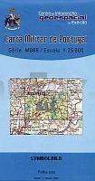
 | 511 - Topographische Landkarte Portugal 1:25.000 Carta Militar de Portugal - Série M888 Instituto Geográfico do Exército (IGeoE) - Portugal |
 | 0482-1 SANGARCÃA Topographische Landkarte 1:25.000 Spanien (Grundlage MTN25) Instituto Geográfico Nacional - CNIG Spanien - ProjektNord |
 | 0768-3 AYORA Topographische Landkarte 1:25.000 Spanien (Grundlage MTN25) Instituto Geográfico Nacional - CNIG Spanien - ProjektNord |
 | 3234 06 Rauhamäki Topographische Karte 1:20.000 (Maastokartta / Peruskartta / Grundkarta) Maanmittauslaitos / Lantmäteriverket Finnland - ProjektNord |
 | Deep Sky Reiseatlas *** SCHNÃPPCHEN *** Sternhaufen, Nebel und Galaxien schnell und sicher finden - Michael Feiler, Philip Noack - Oculum-Verlag |
 | Königreich SACHSEN im Deutschen Reich um 1905 - Historische Landkarte Nachdruck Planokarte - gerollt - Verlag Rockstuhl |
 | 1097-3_4 ARICO Topographische Landkarte 1:25.000 Spanien (Grundlage MTN25) Instituto Geográfico Nacional - CNIG Spanien - ProjektNord |
 | 0652-2 ALMARAZ Topographische Landkarte 1:25.000 Spanien (Grundlage MTN25) Instituto Geográfico Nacional - CNIG Spanien - ProjektNord |
 | 4313 09 Räsävaara Topographische Karte 1:20.000 (Maastokartta / Peruskartta / Grundkarta) Maanmittauslaitos / Lantmäteriverket Finnland - ProjektNord |
 | Naleczow und Umgebung 1:25.000 - Wanderkarte - Radwanderkarte - Cartomedia - Sygnatura Polen Nałęczów i okolice |
 | 58G SWALMEN Topographische Karte der Niederlande 1:25.000 (Plotausgabe) 58G Swalmen Topografische Kaart van Nederland Kadaster - ProjektNord |
 | L3722 Barsinghausen (geplottete Ausgabe) Topographische Karte 1:50.000 Kartografie Landesvermessungsamt Niedersachsen - ProjektNord |
 | 2024 Kellinghusen - Gestern und Heute - Historische Ãberlagerung 1902-1930 Topographische Landkarte 1:25.000 im Vergleich - Landesvermessungsamt Schleswig-Holstein / ProjektNord |
 | 0755-4 TALARRUBIAS Topographische Landkarte 1:25.000 Spanien (Grundlage MTN25) Instituto Geográfico Nacional - CNIG Spanien - ProjektNord |
 | 0707-1 BERZOCANA Topographische Landkarte 1:25.000 Spanien (Grundlage MTN25) Instituto Geográfico Nacional - CNIG Spanien - ProjektNord |
| Finnischer Meerbusen (West) Seekarte 952 - 1:250.000 Läntinen Suomenlahti Yleismerikartta 952 - 1:250.000 Finnland |
 | P531 Outokumpu Topographische Karte 1:50.000 EUREF-FIN (Maastokarttat) Maanmittauslaitos / Lantmäteriverket Finnland - ProjektNord |
| 1525 Eckernförde - Gestern und Heute - Historische Ãberlagerung 1878-1880 Topographische Landkarte 1:25.000 im Vergleich - Landesvermessungsamt Schleswig-Holstein / ProjektNord |
 | 1019-1 ISLA MAYOR Topographische Landkarte 1:25.000 Spanien (Grundlage MTN25) Instituto Geográfico Nacional - CNIG Spanien - ProjektNord |
 | 0371-3 VILLALAR DE LOS COMUNEROS Topographische Landkarte 1:25.000 Spanien (Grundlage MTN25) Instituto Geográfico Nacional - CNIG Spanien - ProjektNord |