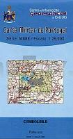
| << Portugal: Amtliche topografische Landkarten des Instituto Geográfico do Exército (IGeoE) 1:25.000 (Serie M888) |
||
|
||

Zuletzt angesehene Artikel:
 | 498 - Grega Topographische Landkarte Portugal 1:25.000 Carta Militar de Portugal - Série M888 Instituto Geográfico do Exército (IGeoE) - Portugal |
 | 0678 CASAR DE CÃCERES Topographische Landkarte 1:50.000 Spanien (Grundlage MTN50) Instituto Geográfico Nacional - CNIG Spanien - ProjektNord |
 | 561-2 PASTRANA Amtliche topographische Landkarte 1:25.000 Spanien (M.T.N.) 561-2 Mapa Topográfico Nacional de Espana (MTN25) Instituto Geográfico Nacional - CNIG Spanien |
 | 75-2 LA RIELA Amtliche topographische Landkarte 1:25.000 Spanien (M.T.N.) 75-2 Mapa Topográfico Nacional de Espana (MTN25) Instituto Geográfico Nacional - CNIG Spanien |
 | 2313-IV-Nà Endelave Topographische Karte Dänemark 1:25.000 Topografisk kort Danmark (DTK/Kort25) 2313-IV-Nà ProjektNord - Kort & Matrikelstyrelsen / Geodætisk Institut |
 | 0993 Gilge Topographische Karte 1:25.000 Messtischblatt des Deutschen Reiches - PreuÃische Landesaufnahme / Reichsamt für Landesaufnahme - Faksimile ProjektNord |
 | 0908 SANTIAGO DE LA ESPADA Topographische Landkarte 1:50.000 Spanien (Grundlage MTN50) Instituto Geográfico Nacional - CNIG Spanien - ProjektNord |
| 2382 Sommerau Topographische Karte 1:25.000 Messtischblatt des Deutschen Reiches - PreuÃische Landesaufnahme / Reichsamt für Landesaufnahme - Faksimile ProjektNord |
 | 0831-2 ZALAMEA DE LA SERENA Topographische Landkarte 1:25.000 Spanien (Grundlage MTN25) Instituto Geográfico Nacional - CNIG Spanien - ProjektNord |
| 5053 Seifhennersdorf-Rumburg (87) - Geologische Karte 1:25.000 (GK25) Grundlage Messtischblatttopographie Sächsisches Landesamt für Umwelt, Landwirtschaft und Geologie |
 | 743-2 FUENTEALBILLA Amtliche topographische Landkarte 1:25.000 Spanien (M.T.N.) 743-2 Mapa Topográfico Nacional de Espana (MTN25) Instituto Geográfico Nacional - CNIG Spanien |
 | 5817 Frankfurt West - Wanderkarte mit Wanderwegen (geplottete Ausgabe) Topographische Landkarte Hessen 1:25.000 - ProjektNord (geplottete Ausgabe) |
| 4056 Bobersberg Topographische Karte 1:25.000 Messtischblatt des Deutschen Reiches - PreuÃische Landesaufnahme / Reichsamt für Landesaufnahme - Faksimile ProjektNord |
 | 2013 02 Hästö Topographische Karte 1:20.000 (Maastokartta / Peruskartta / Grundkarta) Maanmittauslaitos / Lantmäteriverket Finnland - ProjektNord |
 | Dômes-Sancy guide équestre - Volcans d`Auvergne Reitführer (französisch) Dômes-Sancy guide équestre - Volcans d`Auvergne - Randonnées à cheval Chamina - Frankreich |
 | S10 Mittenwald - Krün - Soierngruppe - Karwendelgebirge-West, Scharnitz, Leutaschtal ATK25 Topographische Karte 1:25.000 (Atkis) Bayern Landesvermessungsamt Bayern - Wanderkarte - Radwanderkarte |
| Kleine Beskiden Wanderkarte 1:40.000 (Westbeskiden) Laminierte Ausgabe Beskid Mały (wyd. lamin.) Compass - Polen |
 | 254-4 GOSOL Amtliche topographische Landkarte 1:25.000 Spanien (M.T.N.) 254-4 Mapa Topográfico Nacional de Espana (MTN25) Instituto Geográfico Nacional - CNIG Spanien |
 | 0598-4 TEJEDA DE TIÃTAR Topographische Landkarte 1:25.000 Spanien (Grundlage MTN25) Instituto Geográfico Nacional - CNIG Spanien - ProjektNord |
 | DEUTSCHLAND zur Zeit der Hohenstaufen und bis 1273 - Historische Landkarte Nachdruck Das römisch-deutsche Reich und das Herrschaftsgebiet von Barbarossa (Friedrich I.) - von Karl von Spruner - Planokarte - gerollt - Verlag Rockstuhl |