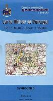
| << Portugal: Amtliche topografische Landkarten des Instituto Geográfico do Exército (IGeoE) 1:25.000 (Serie M888) |
||
|
||

Zuletzt angesehene Artikel:
 | 412 - Topographische Landkarte Portugal 1:25.000 Carta Militar de Portugal - Série M888 Instituto Geográfico do Exército (IGeoE) - Portugal |
 | 5571 Friedland O. S. Topographische Karte 1:25.000 Messtischblatt des Deutschen Reiches - PreuÃische Landesaufnahme / Reichsamt für Landesaufnahme - Faksimile ProjektNord |
| 2374 Zalesie Topographische Karte 1:25.000 Messtischblatt des Deutschen Reiches - PreuÃische Landesaufnahme / Reichsamt für Landesaufnahme - Faksimile ProjektNord |
 | 0477-3 ALDEHUELA DE LA BÃVEDA Topographische Landkarte 1:25.000 Spanien (Grundlage MTN25) Instituto Geográfico Nacional - CNIG Spanien - ProjektNord |
 | 248-A - Topographische Landkarte Portugal 1:25.000 Carta Militar de Portugal - Série M888 Instituto Geográfico do Exército (IGeoE) - Portugal |
 | 0482 VALVERDE DEL MAJANO Topographische Landkarte 1:50.000 Spanien (Grundlage MTN50) Instituto Geográfico Nacional - CNIG Spanien - ProjektNord |
 | 0673 ILLA DE LAIRE Topographische Landkarte 1:50.000 Spanien (Grundlage MTN50) Instituto Geográfico Nacional - CNIG Spanien - ProjektNord |
| 4165 Lissa (Wartheland) Topographische Karte 1:25.000 Messtischblatt des Deutschen Reiches - PreuÃische Landesaufnahme / Reichsamt für Landesaufnahme - Faksimile ProjektNord |
 | 30 Germil (Ponte da Barca) Topographische Landkarte Wanderkarte und Fahrradkarte Portugal 1:25.000 030 Mapa topográfico - Mapa de caminhadas - Portugal 1:25.000 ProjektNord |
 | 310 Tomar - Topographische Landkarte Portugal 1:25.000 Carta Militar de Portugal - Série M888 Instituto Geográfico do Exército (IGeoE) - Portugal |
 | 1036-II Olvera Amtliche topographische Landkarte 1:25.000 Spanien (M.T.N.) 1036-II Mapa Topográfico Nacional de Espana (MTN25) Instituto Geográfico Nacional - CNIG Spanien |
 | 45-3 CERCEDA Amtliche topographische Landkarte 1:25.000 Spanien (M.T.N.) 45-3 Mapa Topográfico Nacional de Espana (MTN25) Instituto Geográfico Nacional - CNIG Spanien |
| 5474 Gr. Stein Topographische Karte 1:25.000 Messtischblatt des Deutschen Reiches - PreuÃische Landesaufnahme / Reichsamt für Landesaufnahme - Faksimile ProjektNord |
 | Kopaonik National Park 1:40.000 Touristische Landkarte Serbien - Kosovo Geokarta D.O.O. Kopaonik - Planinarsko Turistitschka Karta |
| 2587 Gardienen Topographische Karte 1:25.000 Messtischblatt des Deutschen Reiches - PreuÃische Landesaufnahme / Reichsamt für Landesaufnahme - Faksimile ProjektNord |
 | 013 Nationalpark Donau-Auen - Lobau - Hainburg - Marchegg - Gänserndorf - Bruck a.d. Leitha 1:50.000 - Wanderkarte / Radwanderkarte Ãsterreich - GPS - Freytag & Berndt |
 | Umgebung von Paris *** SCHNÃPPCHEN *** StraÃenkarte Zoom 1:90.000 / 1:17.000 (Blatt 102) wasserfest - reiÃfest Paris et ses alentours Michelin |
| 5670 Ziegenhals Topographische Karte 1:25.000 Messtischblatt des Deutschen Reiches - PreuÃische Landesaufnahme / Reichsamt für Landesaufnahme - Faksimile ProjektNord |
 | Oberlausitzer Heide- und Teichlandschaft und Umgebung - Radwander- und Wanderkarte 1:50.000 (Nr. 147) Radwander- und Wanderkarte. Ausflüge im Biosphärenreservat zwischen Boxberg, Rothenburg, Niesky, Guttau, WeiÃenberg und Bautzen. 1:50000, Radtourenvorschläge m. Entfernungsangaben. Viele Tipps zu Sehenswürdigkeiten Dr. Barthel Verlag |
 | 1097 GRANADILLA DE ABONA Topographische Landkarte 1:50.000 Spanien (Grundlage MTN50) Instituto Geográfico Nacional - CNIG Spanien - ProjektNord |