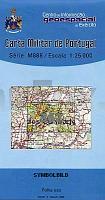
| << Portugal: Amtliche topografische Landkarten des Instituto Geográfico do Exército (IGeoE) 1:25.000 (Serie M888) |
||
|
||

Zuletzt angesehene Artikel:
 | 362 Ramalhal (Torres Vedras) Topographische Landkarte Portugal 1:25.000 Carta Militar de Portugal - Série M888 Instituto Geográfico do Exército (IGeoE) - Portugal |
 | 174 Topographische Landkarte Wanderkarte und Fahrradkarte Portugal 1:25.000 174 Mapa topográfico - Mapa de caminhadas - Portugal 1:25.000 ProjektNord |
 | 108-A Topographische Landkarte Wanderkarte und Fahrradkarte Portugal 1:25.000 108A Mapa topográfico - Mapa de caminhadas - Portugal 1:25.000 ProjektNord |
 | 525 Topographische Landkarte Wanderkarte und Fahrradkarte Portugal 1:25.000 525 Mapa topográfico - Mapa de caminhadas - Portugal 1:25.000 ProjektNord |
 | 51 Topographische Landkarte Wanderkarte und Fahrradkarte Portugal 1:25.000 051 Mapa topográfico - Mapa de caminhadas - Portugal 1:25.000 ProjektNord |
 | 465 - Topographische Landkarte Portugal 1:25.000 Carta Militar de Portugal - Série M888 Instituto Geográfico do Exército (IGeoE) - Portugal |
 | 197 Topographische Landkarte Wanderkarte und Fahrradkarte Portugal 1:25.000 197 Mapa topográfico - Mapa de caminhadas - Portugal 1:25.000 ProjektNord |
 | 164 Topographische Landkarte Wanderkarte und Fahrradkarte Portugal 1:25.000 164 Mapa topográfico - Mapa de caminhadas - Portugal 1:25.000 ProjektNord |
 | 345 Topographische Landkarte Wanderkarte und Fahrradkarte Portugal 1:25.000 345 Mapa topográfico - Mapa de caminhadas - Portugal 1:25.000 ProjektNord |
 | 0506-4 MEDIANA DE VOLTOYA Topographische Landkarte 1:25.000 Spanien (Grundlage MTN25) Instituto Geográfico Nacional - CNIG Spanien - ProjektNord |
 | Glatzer Bergland 1:90.000 Lamininierte Landkarte Ziemia Kłodzka - Laminowana mapa turystyczna Euro Pilot - Daunpol - Polen |
 | 750 km à vélo - Coeur de l´Ardenne et du Parc naturel des Deux Ourthes Touristische Radwanderkarte Belgien NGI Belgien |
 | Allensteiner und Oberländische Seenplatte Touristische Landkarte und Wanderkarte Polen 1:125.000 Pojezierze Olsztynskie i Ilawskie - FOTKART |
 | Isarradweg, Vom Ursprung bis zur Mündung Leporello Radtourenkarte mit Ausflugszielen, Einkehr- & Freizeittipps, StraÃennamen, wetterfest, reissfest, abwischbar, GPS-genau. 1:50000 - von - Freytag-Berndt und ARTARIA PUBLICPRESS |
 | Lombardei - Mailand - Oberitalienische Seen 1:150.000 (Blatt AK 0612) Auto- + Freizeitkarte Italien Lombardy, Milan, North-Italian Lakes Lombardia, Milano, Lagi italiani settentrional freytag & berndt |
 | Dresden, Sächsische Schweiz und Umgebung - Ausflugskarte 1:125.000 (Nr. 199) Unterwegs zwischen Riesa, Kamenz, Bautzen, Ãstà nad Labem, DecÃn, Altenberg, Freiberg und MeiÃen. 1:125.000, Die Sehenswürdigkeiten der Region Dr. Barthel Verlag |
 | GreenVelo: Woiwodschaft Karpatenvorland 1:100.000 Radwanderkarte der Radwege - Steinpapier Województwo podkarpackie GreenVelo mapa tras rowerowych (papier skalny) Europilot - Daunpol - Polen |
 | M14 Vilsbiburg - Velden., Geisenhausen, Taufkirchen (Vils), Buchbach, Altfraunhofen, Bodenkirchen *** SCHNÃPPCHEN *** ATK25 Topographische Karte 1:25.000 (Atkis) Bayern Landesvermessungsamt Bayern - Wanderkarte |
 | Nationalpark Pieninen Touristische Landkarte 1:25.000 Wanderkarte / Landkarte, laminiert Pieniński Park Narodowy mapa PLAN Galileos - Polen |
 | 3D NO KRISTIANSTAD 1:50.000 *** SCHNÃPPCHEN *** Topographische Wanderkarte Schweden (Terrängkarta/Gröna Kartan) - Kartförlaget - Lantmäteriet Landkarte Schweden |