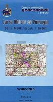
| << Portugal: Amtliche topografische Landkarten des Instituto Geográfico do Exército (IGeoE) 1:25.000 (Serie M888) |
||
|
||

Zuletzt angesehene Artikel:
 | 348 Marvao Topographische Landkarte Portugal 1:25.000 Carta Militar de Portugal - Série M888 Instituto Geográfico do Exército (IGeoE) - Portugal |
 | Mit dem Wohnmobil nach Mecklenburg-Vorpommern -Teil 1 (Band 87) Meckenburgische Seen - Wismarer Bucht - WOMO, Wohnmobil, Camping, Urlaub, Reise - von Stefanie Holtkamp - Womo Verlag |
 | Vegeriai (45-49/70-74) Topografische Karte Litauen 1:50.000 Lietuvos Respublikos Topografinis Zemelapis 1:50.000 - Nacionaline Zemes Tarnyba - Litauen |
 | 609-2 CHILLARÃN DE CUENCA Amtliche topographische Landkarte 1:25.000 Spanien (M.T.N.) 609-2 Mapa Topográfico Nacional de Espana (MTN25) Instituto Geográfico Nacional - CNIG Spanien |
 | 577 Malhada Quente (Monchique) Topographische Landkarte Portugal 1:25.000 Carta Militar de Portugal - Série M888 Instituto Geográfico do Exército (IGeoE) - Portugal |
| N-33-132-A/B Gniezno Amtliche topographische Landkarte Polen 1:50.000 N-33-132-A/B Gniezno - Mapa Topograficzna Polski Glowny Geodeta Kraju |
 | 2724 04 Kätkäsuvanto Topographische Karte 1:20.000 (Maastokartta / Peruskartta / Grundkarta) Maanmittauslaitos / Lantmäteriverket Finnland - ProjektNord |
| Tunguska (Amur) - Flusskarte 1:60.000 Reka Tunguska Karta-shema / Тунгуска (приток Амура) Dal`newostochnyj Federal`nyj Okrug - Russland |
 | 40 Viana do Castelo - Topographische Landkarte Portugal 1:25.000 Carta Militar de Portugal - Série M888 Instituto Geográfico do Exército (IGeoE) - Portugal |
 | 1334 05 Särkimo Topographische Karte 1:20.000 (Maastokartta / Peruskartta / Grundkarta) Maanmittauslaitos / Lantmäteriverket Finnland - ProjektNord |
 | 949 Amtliche topographische Landkarte 1:50.000 Spanien (M.T.N.) 949 Mapa Topográfico Nacional de Espana (MTN50) Instituto Geográfico Nacional - CNIG Spanien |
 | 3233 01 Juva Topographische Karte 1:20.000 (Maastokartta / Peruskartta / Grundkarta) Maanmittauslaitos / Lantmäteriverket Finnland - ProjektNord |
| 4668 Trebnitz in Niederschlesien Topographische Karte 1:25.000 Messtischblatt des Deutschen Reiches - PreuÃische Landesaufnahme / Reichsamt für Landesaufnahme - Faksimile ProjektNord |
 | Generalkarte des Baltenlandes (Estland - Kurland - Livland) 1:725.000 von Carl Flemming 1917 - Historische Landkarte Nachdruck POSTER 69 x 86 cm |
 | Dänemark Erlebnisrouten durch das Königreich zwischen Nord- und Ostsee - von Schabe, TobiasRoth, RosannaSchabe, Tobias - MOBIL & AKTIV ERLEBEN Wohnmobil Reiseführer |
 | Warthebruch Nationalpark und Umgebung 1:50.000 Touristische Landkarte und Wanderkarte (Blatt 302) Park Narodowy Ujscie Warty i okolice - Sygnatura - Polen |
 | Rund um die Tatra - Karte der Sehenswürdigkeiten des polnischen und slowakischen Tatravorlandes - Touristische Landkarte 1:120.000 Wokół Tatr - mapa atrakcji polskiego i słowackiego Podtatrza Compass - Polen |
| 4854 Löbau-Reichenbach (56) - Geologische Karte 1:25.000 (GK25) Grundlage Vollbornsche Ãquidistantenkarte Sächsisches Landesamt für Umwelt, Landwirtschaft und Geologie |
 | 2734 09 KUMPUTUNTURI Topographische Karte 1:20.000 (Maastokartta / Peruskartta / Grundkarta) Maanmittauslaitos / Lantmäteriverket Finnland - ProjektNord |
 | Fars Province & Shiraz City (Blatt 364) 1:1.1 Mio. Landkarte Persisch نقشه استان فارس و شهر شيراز Gitashenasi - Iran |