| << Portugal: Amtliche topografische Landkarten des Instituto Geográfico do Exército (IGeoE) 1:25.000 (Serie M888) |
||
|
||

Zuletzt angesehene Artikel:
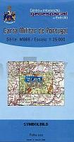
 | 273 - Topographische Landkarte Portugal 1:25.000 Carta Militar de Portugal - Série M888 Instituto Geográfico do Exército (IGeoE) - Portugal |
 | NL 32-03-22 Ost (2222-Ost) Seefeld in Tirol Ãsterreichische Karte 1:25.000 mit Wegmarkierungen (topographische Wanderkarte - UTM) - BEV - Ãsterreich - VergröÃerung (ÃK25V) |
 | 0624-2 TALAYUELA Topographische Landkarte 1:25.000 Spanien (Grundlage MTN25) Instituto Geográfico Nacional - CNIG Spanien - ProjektNord |
 | NL 32-03-15 Ost (2215-Ost) Zugspitze Ãsterreichische Karte 1:25.000 mit Wegmarkierungen (topographische Wanderkarte - UTM) - BEV - Ãsterreich - VergröÃerung (ÃK25V) |
 | 1052-1 ÃLORA Topographische Landkarte 1:25.000 Spanien (Grundlage MTN25) Instituto Geográfico Nacional - CNIG Spanien - ProjektNord |
 | 2114-III-Sà - Hemmet Topographische Karte Dänemark 1:25.000 Topografisk kort Danmark (DTK/Kort25) 2114-III-Sà ProjektNord - Kort & Matrikelstyrelsen / Geodætisk Institut |
 | Mountain Bike im Abruzzen-Park Mountainbike-Führer von Giancarlo Cappellari Mountain Bike nel Parco d`Abruzzo - 20 itinerari e un bici trekking Edizioni Il Lupo |
 | 463 - Topographische Landkarte Portugal 1:25.000 Carta Militar de Portugal - Série M888 Instituto Geográfico do Exército (IGeoE) - Portugal |
 | 423 - Topographische Landkarte Portugal 1:25.000 Carta Militar de Portugal - Série M888 Instituto Geográfico do Exército (IGeoE) - Portugal |
 | 1023-4 ANTEQUERA Topographische Landkarte 1:25.000 Spanien (Grundlage MTN25) Instituto Geográfico Nacional - CNIG Spanien - ProjektNord |