| << Portugal: Amtliche topografische Landkarten des Instituto Geográfico do Exército (IGeoE) 1:25.000 (Serie M888) |
||
|
||

Zuletzt angesehene Artikel:
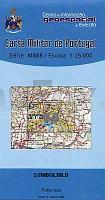
 | 64 - Topographische Landkarte Portugal 1:25.000 Carta Militar de Portugal - Série M888 Instituto Geográfico do Exército (IGeoE) - Portugal |
 | 14-11 Nove Mesto nad Metuji Topographische Karte 1:50.000 der Tschechischen Republik Zakladnà mapa Ceská republika - Cesky urad zememericky a katastralni - ProjektNord |
 | Volcans d`Auvergne à pied - Massif Central Wanderführer - Mountainbikeführer (französisch) Volcans d`Auvergne à pied - Massif Central - Incontournables à pied Chamina - Frankreich |
 | Penkun Topographische Karte 1:25.000 Messtischblatt des Deutschen Reiches - PreuÃische Landesaufnahme / Reichsamt für Landesaufnahme - Faksimile ProjektNord |
| 1718 Vollerwiek - Gestern und Heute - Historische Ãberlagerung 1932-1950 Topographische Landkarte 1:25.000 im Vergleich - Landesvermessungsamt Schleswig-Holstein / ProjektNord |
| Punsk Topographische Karte 1:25.000 Messtischblatt des Deutschen Reiches - PreuÃische Landesaufnahme / Reichsamt für Landesaufnahme - Faksimile ProjektNord |
| Nowogrod Topographische Karte 1:25.000 Messtischblatt des Deutschen Reiches - PreuÃische Landesaufnahme / Reichsamt für Landesaufnahme - Faksimile ProjektNord |
 | 0967 BAENA Topographische Landkarte 1:50.000 Spanien (Grundlage MTN50) Instituto Geográfico Nacional - CNIG Spanien - ProjektNord |
| 1423 Schleswig - Gestern und Heute - Historische Ãberlagerung 1953-1956 Topographische Landkarte 1:25.000 im Vergleich - Landesvermessungsamt Schleswig-Holstein / ProjektNord |
| 5874 PreuÃ. Krawarn Topographische Karte 1:25.000 Messtischblatt des Deutschen Reiches - PreuÃische Landesaufnahme / Reichsamt für Landesaufnahme - Faksimile ProjektNord |
 | 0155 CHANTADA Topographische Landkarte 1:50.000 Spanien (Grundlage MTN50) Instituto Geográfico Nacional - CNIG Spanien - ProjektNord |
 | Zaborski Landschaftspark, Nationalpark Tucheler Heide Landkarte und touristischer Reiseführer Zaborski Park Krajobrazowy, Park Narodowy Bory Tucholskie PLAN Galileos - Polen |
 | 0449 VILVESTRE Topographische Landkarte 1:50.000 Spanien (Grundlage MTN50) Instituto Geográfico Nacional - CNIG Spanien - ProjektNord |
 | 103 Utherad Topographische Karte Island 1:100.000 - Ferdakort 103 ÃTHÃRAà - Atlaskort - Ferðakort |
 | Biosphärenreservat Nord-Livland Touristische Landkarte Lettland 1:200.000 Ziemelvidzemes fisferas rezervats - Jana Seta |
 | 0887 ORCERA Topographische Landkarte 1:50.000 Spanien (Grundlage MTN50) Instituto Geográfico Nacional - CNIG Spanien - ProjektNord |
| Gramzow Topographische Karte 1:25.000 Messtischblatt des Deutschen Reiches - PreuÃische Landesaufnahme / Reichsamt für Landesaufnahme - Faksimile ProjektNord |
 | 0192 LUCILLO Topographische Landkarte 1:50.000 Spanien (Grundlage MTN50) Instituto Geográfico Nacional - CNIG Spanien - ProjektNord |
 | 92 Guhrau - Wohlau - Rawitsch - Karte des Deutschen Reiches 1:100.000 (KDR 100 GB) - GroÃblatt Reichsamt für Landesaufnahme / PreuÃische Landesaufnahme ProjektNord |
 | 2044 05 Ridasjärvi Topographische Karte 1:20.000 (Maastokartta / Peruskartta / Grundkarta) Maanmittauslaitos / Lantmäteriverket Finnland - ProjektNord |