| << Portugal: Amtliche topografische Landkarten des Instituto Geográfico do Exército (IGeoE) 1:25.000 (Serie M888) |
||
|
||

Zuletzt angesehene Artikel:
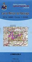
 | 19 - Topographische Landkarte Portugal 1:25.000 Carta Militar de Portugal - Série M888 Instituto Geográfico do Exército (IGeoE) - Portugal |
 | Lutbrandau Topographische Karte 1:25.000 Messtischblatt des Deutschen Reiches - PreuÃische Landesaufnahme / Reichsamt für Landesaufnahme - Faksimile ProjektNord |
 | 131 - Topographische Landkarte Portugal 1:25.000 Carta Militar de Portugal - Série M888 Instituto Geográfico do Exército (IGeoE) - Portugal |
 | 1003 Utrera Amtliche topographische Landkarte 1:50.000 Spanien (M.T.N.) 1003 Mapa Topográfico Nacional de Espana (MTN50) Instituto Geográfico Nacional - CNIG Spanien |
| 5468 Lindenau Topographische Karte 1:25.000 Messtischblatt des Deutschen Reiches - PreuÃische Landesaufnahme / Reichsamt für Landesaufnahme - Faksimile ProjektNord |
 | Oberbayern, Motorradkarte 1:250.000, freytag & berndt Tirol - Südtirol, Toureninfos, GPX Tracks, wasserfest und reiÃfest - von freytag & berndt - Freytag-Berndt und ARTARIA |
| 2286 Thierberg Topographische Karte 1:25.000 Messtischblatt des Deutschen Reiches - PreuÃische Landesaufnahme / Reichsamt für Landesaufnahme - Faksimile ProjektNord |
 | 0391 IGUALADA Topographische Landkarte 1:50.000 Spanien (Grundlage MTN50) Instituto Geográfico Nacional - CNIG Spanien - ProjektNord |
 | 1069-2 MEDINA-SIDONIA Topographische Landkarte 1:25.000 Spanien (Grundlage MTN25) Instituto Geográfico Nacional - CNIG Spanien - ProjektNord |
 | W261 Pfullendorf - Wanderkarte Schwäbische Alb 1:25.000 Deggenhausertal, Illmensee - von Schwäbischer Albverein / LGL - Landesamt für Geoinformation und Landentwicklung Baden-Württemberg (LGL) |
 | 384-4 Fuentes de Ebro Amtliche topographische Landkarte 1:25.000 Spanien (M.T.N.) 384-4 Mapa Topográfico Nacional de Espana (MTN25) Instituto Geográfico Nacional - CNIG Spanien |
 | Karpaten: Zdanievo - Polonina - Runa - Pikuj Topographische Wanderkarte 1:50.000 Karpaten - Ukraine Karpati Zdanievo - Polonina - Runa - Pikuj -Жденієво г. Полонина Руна - г. Пікуй Kartografija - ukrmap Ukraine |
 | V421 Palojoensuu Topographische Karte 1:50.000 EUREF-FIN (Maastokarttat) Maanmittauslaitos / Lantmäteriverket Finnland - ProjektNord |
 | NL 33-01-20 West (3220-West) Mittersill Ãsterreichische Karte 1:25.000 mit Wegmarkierungen (topographische Wanderkarte - UTM) - BEV - Ãsterreich - VergröÃerung (ÃK25V) |
 | 55-2 Inguanzo Amtliche topographische Landkarte 1:25.000 Spanien (M.T.N.) 55-2 Mapa Topográfico Nacional de Espana (MTN25) Instituto Geográfico Nacional - CNIG Spanien |
 | 73-2 MOSTEIRO Amtliche topographische Landkarte 1:25.000 Spanien (M.T.N.) 73-2 Mapa Topográfico Nacional de Espana (MTN25) Instituto Geográfico Nacional - CNIG Spanien |
 | Karpaten StraÃenatlas 1:250.000 (Ukrainische Karpaten) Karpati Atlas awtoturista Kartografija - ukrmap Ukraine |
 | W514 Nammijärvi Topographische Karte 1:50.000 EUREF-FIN (Maastokarttat) Maanmittauslaitos / Lantmäteriverket Finnland - ProjektNord |
| 6077 Jastrzemb Topographische Karte 1:25.000 Messtischblatt des Deutschen Reiches - PreuÃische Landesaufnahme / Reichsamt für Landesaufnahme - Faksimile ProjektNord |
| 2762 Spechtsdorf Topographische Karte 1:25.000 Messtischblatt des Deutschen Reiches - PreuÃische Landesaufnahme / Reichsamt für Landesaufnahme - Faksimile ProjektNord |