| << Portugal: Amtliche topografische Landkarten des Instituto Geográfico do Exército (IGeoE) 1:25.000 (Serie M888) |
||
|
||

Zuletzt angesehene Artikel:
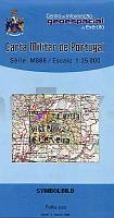
 | 7 - Topographische Landkarte Portugal 1:25.000 Carta Militar de Portugal - Série M888 Instituto Geográfico do Exército (IGeoE) - Portugal |
 | 4673 Rogaszyce Topographische Karte 1:25.000 Messtischblatt des Deutschen Reiches - PreuÃische Landesaufnahme / Reichsamt für Landesaufnahme - Faksimile ProjektNord |
 | 79 - Topographische Landkarte Portugal 1:25.000 Carta Militar de Portugal - Série M888 Instituto Geográfico do Exército (IGeoE) - Portugal |
 | Limburg Süd - Radwanderkarte 1:100.000 Fahrradkarte Niederlande Buijten & Schipperheijn Limburg Zuid leeuwerikroutes via knooppunten |
 | 876-1 VALENCIA DEL VENTOSO Amtliche topographische Landkarte 1:25.000 Spanien (M.T.N.) 876-1 Mapa Topográfico Nacional de Espana (MTN25) Instituto Geográfico Nacional - CNIG Spanien |
| 3573 Powidz Topographische Karte 1:25.000 Messtischblatt des Deutschen Reiches - PreuÃische Landesaufnahme / Reichsamt für Landesaufnahme - Faksimile ProjektNord |
 | LA LOIRE - balades et randonnées Wanderführer - (französisch) Chamina - Frankreich LA LOIRE Auvergne : Allier - Puy-de-Dôme; Rhône-Alpes : Loire - Rhône |
 | 585-2 TINAJAS Amtliche topographische Landkarte 1:25.000 Spanien (M.T.N.) 585-2 Mapa Topográfico Nacional de Espana (MTN25) Instituto Geográfico Nacional - CNIG Spanien |
| 1931 Pelzerhaken - Gestern und Heute - Historische Ãberlagerung 1953-1956 Topographische Landkarte 1:25.000 im Vergleich - Landesvermessungsamt Schleswig-Holstein / ProjektNord |
| 1919 Dieksand - Gestern und Heute - Historische Ãberlagerung 1953-1956 Topographische Landkarte 1:25.000 im Vergleich - Landesvermessungsamt Schleswig-Holstein / ProjektNord |
 | 0680-3 TORRECILLAS DE LA TIESA Topographische Landkarte 1:25.000 Spanien (Grundlage MTN25) Instituto Geográfico Nacional - CNIG Spanien - ProjektNord |
 | 2024 02 Pyöli Topographische Karte 1:20.000 (Maastokartta / Peruskartta / Grundkarta) Maanmittauslaitos / Lantmäteriverket Finnland - ProjektNord |
 | 0960-1 SOTIEL-CORONADA Topographische Landkarte 1:25.000 Spanien (Grundlage MTN25) Instituto Geográfico Nacional - CNIG Spanien - ProjektNord |
| Vilkaviskis (45-49/30-34) Topografische Karte Litauen 1:50.000 Lietuvos Respublikos Topografinis Zemelapis 1:50.000 - Nacionaline Zemes Tarnyba - Litauen |
 | 65 - Topographische Landkarte Portugal 1:25.000 Carta Militar de Portugal - Série M888 Instituto Geográfico do Exército (IGeoE) - Portugal |
 | Provinz La Spezia + 5 Terre (Blatt SV-20/SP-20) Topographische StraÃenkarte und Touristenkarte 1:100.000 mit Radwegen Provincia di La Spezia e 5 Terre - Carta stradale e turistica con piste ciclabili EdM Edizioni del Magistero - Italien |
| Vaskai (60-64/65-69) Topografische Karte Litauen 1:50.000 Lietuvos Respublikos Topografinis Zemelapis 1:50.000 - Nacionaline Zemes Tarnyba - Litauen |
| 1818 Blauort / Helgoland - Gestern und Heute - Historische Ãberlagerung 1878-1880 Topographische Landkarte 1:25.000 im Vergleich - Landesvermessungsamt Schleswig-Holstein / ProjektNord |
 | Kirgiz-Gebiet (Blatt 1) Topografische Landkarte 1:200.000 Kirgizskij hrebet - Kyrgyz Range - Kirgisistan |
 | Jekaterinburg und Vorstädte GroÃer Stadt-Atlas 1:15.000 Bolschoj Atlas Ekaterinburga s prigorodami - Uralskaja Kartografitscheskaja Kompanija - Russland |