 Les deux tiers du dÃĐpartement du Lot, entre le Causse de Limogne au sud, la vallÃĐe de la Dordogne au nord, Figeac à l’est et Cahors à l’ouest. Ce territoire correspond à l’ancienne province du Haut-Quercy. De nombreux sites touristiques prestigieux sont visitÃĐs : Rocamadour (plus d’1,5 millions de visiteurs par an, classÃĐ au patrimoine mondial de l’UNESCO, au titre des Chemins de Saint-Jacques), gouffre de Padirac, vallÃĐes du Lot et du CÃĐlÃĐ (Saint-Cirq-Lapopie, Cajarc, etc.). Un territoire qui offre une diversitÃĐ naturelle remarquable (Causses, vignoble, falaises calcaires, gouffres, etc.) et une architecture de pierres blondes connue dans le monde entier. * 48 pages
* Format pratique : 12 x 21 cm
* Introduction gÃĐnÃĐrale avec prÃĐsentation du territoire (plusieurs thÃĻmes dÃĐveloppÃĐs qui enrichissent la connaissance des sites traversÃĐs)
* 20 itinÃĐraires de 1h30 Ã 5h00 pour une pratique familiale
* Cartographie sur fond IGN au 1 : 25 000 pour se repÃĐrer facilement
* DÃĐtail des centres d’intÃĐrêts
* Renseignements pratiques pour randonner en toute sÃĐcuritÃĐ
* Adresses utiles.  Kartenausschnitt Kartenausschnitt
Kartenbeispiel
|
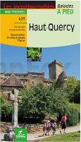
HAUT-QUERCY a pied - Lot - Midi-PyrÃĐnÃĐes - 20 balades exceptionelles Les incontournables Balades - WanderfÞhrer - (franzÃķsisch) Chamina - Frankreich
EAN / ISBN: 9782844666611
Preis: EUR 13.90
|
|


