 Detailed map showing the position of over 440 ski resorts across the Alps, and how to reach them. Charting the position of over 440 resorts across the entire Alpine region, from Lyon to Ljubljana and Milan to Munich, this clear and detailed winter-sports map is the first to focus specifically on rail routes through the Alps, enabling travellers to plan their journeys to winter sports resorts by train from throughout Europe as well as from Alpine airports. Rail is becoming an increasingly popular choice for people travelling across, and to, the Alps. It offers a much more pleasant alternative to the conventional flight-and-coach combination, and imposes a greatly reduced carbon footprint compared with road and air-based alternatives. Key features of the map include: - The entire Alpine Region at an approximate scale of 1:1.4 Mio. Clear mapping showing:
- rail network through the Alps
- locations of over 440 Alpine resorts from well-known names to lesser-known gems
- Rail routes to the Alps from over ten European countries with approximate journey times
- Rail lines classified according to size with high speed rail lines highlighted. Major rail tunnels shown plus mountain railways and connecting cable cars Detailed information on over 100 ski resorts directly accessible by train including:
- extent of downhill and cross-country skiing
- altitude range and vertical drop
- number of lifts
- difficulty of skiing
- availability of glacier skiing
- rail journey times to the nearest major city Accompanying free booklet containing:
- information on skiing by train in France, Austria, Germany, Switzerland, Italy and Slovenia
- detailed resort information
- airport rail connections  Kartenausschnitt Kartenausschnitt
Kartenbeispiel
|
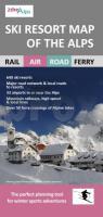
SkiResort Map of the Alps 1:1.4 Mio by Roger Lascelles Maps Ltd.
EAN / ISBN: 9781858797250
Preis: EUR 13.90
|
| 


