 A new GPS edition of our popular 1:50000 scale outdoor activity map of the Jebel el Kest Massif, including the summit of Jebel el Kest, the Ameln Valley, Tafraout, the Tarakatine Pass, Sidi M`Zal, Idaougnidif, and the Amzkhssan Gorge. OAC MiniMaps are the most detailed and accurate maps currently available for Morocco`s Anti-Atlas mountains near Tafraout. These 1:50000 scale maps are drawn in a similar style to British OS maps, and are ideal for all outdoor activities in the Anti-Atlas region, including hillwalking, climbing, and scrambling, as well as exploring the region by car or bike. The Anti-Atlas range is covered by 4 miniMap sheets as follows: Sheet 1: Jebel Taskra massif, showing the Tizi N`Takoucht escarpment from Idaougnidif to Taskra, including the Kasbah Tizourgane and Aouguenz road. Sheet 2: Tanalt, showing the Amaghouz Gorge, Tanalt, Tagzene, Tagmout, Samazar and western Afantinzar. Sheet 3: Ameln, showing the summit of Jebel el Kest, the Ameln Valley, Tarakatine Pass and the eastern escarpment of Sidi M`Zal. Sheet 4: Tafraout, showing the granite back-country including Aguerd Oudad and the Painted Rocks.  Blattschnitte der Outdoor Activity Maps Blattschnitte der Outdoor Activity Maps
Blattübersicht aller Karten vom Oxford Alpine Club Kartenausschnitt
Kartenbeispiel
|
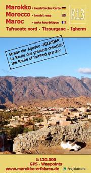
3: Ameln - Tafraout - Ameln - Sidi M´Zal - Idaougnidif & Afantinzar 1:50.000 GPS - wasserfest Outdoor Activity Map for climbers, trekkers and tourists - Oxford Alpine Club
Preis: EUR 14.90
|
| 


