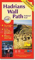
 Hadrian`s Wall Path - this popular long-distance route runs for 86 miles between Bowness-on-Solway on the Cumbrian coast, and Wallsend on Tyneside. It passes through some of England`s most striking landscapes as it follows the line of the old Roman frontier wall for much of the way. The map is divided into eight sections, each displayed on a separate panel, and folds easily to show a particular part of the path.  Kartenausschnitt Kartenausschnitt
|
Hadrian`s Wall Path - Wanderkarte Bowness to/from Wallsend - Footprint Maps - Stirling Surveys
EAN / ISBN: 9781871149807
Preis: EUR 13.90
|
| 


