Willkommen bei MapFox
+++ Buchhändleranfragen willkommen! Tel. 0431-666 75 99 +++
Warenkorb
Artikel: 0
€ 0.00

Zur Kasse
Impressum Kontakt Versandkosten AGB Partnerprogramm Links
Aktuelle Infos

Erweitertes Sortiment

Stöbern

Europa-Übersichtskarte


NEU im Sortiment
Geschenkgutscheine
Individuelle Landkarten
Poster, Wandkarten, Reliefkarten
Globen
Landkarten-Puzzles
Europa - allgemein
Welt - allgemein
Außereuropäische Länder
Albanien
Andorra
Baltikum
Bosnien-Herzegowina
Bulgarien
Belgien
Benelux
Dänemark
Deutschland
Estland
Finnland
Frankreich
Griechenland
Großbritannien
Irland
Island
Italien
Kosovo
Kroatien
Lettland
Liechtenstein
Litauen
Luxemburg
Malta
Mittelmeer und Mittelmeer-Inseln
Moldawien
Montenegro
Niederlande
Nordmazedonien
Norwegen
Österreich
Polen
Portugal
Rumänien
Russland
Schweden
Schweiz
Serbien
Skandinavien
Slowakei
Slowenien
Spanien
Tschechien
Türkei
Ukraine
Ungarn
Weißrussland (Belarus)
Zypern
Verlage
Digitale Landkarten auf CD-ROM / DVD, SD-Karte
Reisen allgemein
Astronomische Karten und Bücher
NonBooks und Zubehör
Schnäppchen - Restposten - Mängelexemplare
Top-Destinationen
Extra-Sortiment
Wanderwege - Routen - Fernradwege
Literatur über Landkarten, Vermessung, Entdeckungen
Historische Landkarten

Schnäppchen

Gesamtübersicht

Startseite

Thames Path Walking Guide (engl.) - Trailblazer
<< Großbritannien: Wanderführer + Kletterführer
<< Trailblazer Guides
 

The Thames Path is a national trail running for 184 miles from the river’s source at Thames Head near Kemble to the Thames Barrier in London.

The path begins, as the river does, in a meadow in the Cotswolds; its upper reaches lonely and wild. As the waters deepen the settlements along its banks begin to grow in both size and grandeur and, reaching Oxford, the solitude of the river slowly subsides and the trail becomes as much about historic towns, churches, abbeys and castles as it does the river.

Lechlade, Abingdon, Wallingford, Henley ... they all owe their location to the Thames, and different eras, when the river was a life source, a place of conflict, a boundary, a mode of transport and the provider of leisure, which, thankfully - for us, at least - it remains to this day.

Squeezing through the ancient Goring Gap, loomed over by the Chiltern Hills, you pass Runnymede, the site of the signing of Magna Carta, and Windsor Castle. Passing by so many ancient sites, this is as much a walk through history as an easy ramble along a river bank.

The route through London - particularly along the south bank - remains relatively countrified, at least as far as Putney, from which the approaching sights of Westminster and Tower Bridge offer vistas as impressive as any others along the river’s green and scenic upper reaches.

Leaving central London, the regenerated dockland areas of East London lure you to your journey’s end at the Thames Barrier and the conclusion of a most enjoyable and magnificently-varied riparian ramble, quite unlike any other in Britain.

Features

1.  Classic Trailblazer style - In many walking guides the reader has to read a route description then try to relate it to the map. Our guides are easier to use because walking directions, tricky junctions, places to stay and eat, points of interest and walking times are all written onto the maps themselves in the places to which they apply.

With their uncluttered clarity, these are not general-purpose maps but fully-edited maps drawn by walkers for walkers. Downloadable GPS waypoints also included.

2. The largest scale walking maps available - At just under 1:20,000 (8cm or 31/8 inches to 1 mile) our maps are bigger than even the most detailed walking maps currently available in the shops.

3. An all-in-one guide - Trailblazer guides include practical information not usually found in walking guides to the UK: reviews of places to stay, places to eat, attractions along the way and detailed public transport information showing all access points on the path, for weekend and day walkers.

Kartenausschnitt

Kartenbeispiel

Thames Path Walking Guide (engl.) - Trailblazer
EAN / ISBN: 9781912716272
Preis: EUR 19.90

Bestellartikel: versandfertig in ca. 3-7 Tagen. Dieser Artikel wird speziell für Sie bestellt. Keine Rücknahme!
Produkt EUR Anzahl Bestellen
Thames Path Walking Guide (engl.) - Trailblazer 19.90
Versandkostenfrei in Deutschland ab 20,- Bestellwert

incl. MwSt.

Stichworte, die bei der Suche nützlich sein könnten:
Themse-Weg Wanderführer - Thames-Path - Trailblazer - Großbritannien - Großbritannien Wanderführer - Großbritannien Trekkingführer - Großbritannien Klettern - Großbritannien Kletterführer


Startseite  Gesamtübersicht  Allg. Geschäftsbed.  Impressum Aktuelle Infos
  • Aktuelle Karten - Historische Namen
    zweisprachige Landkarten über Polen und das Kaliningrader Gebiet

  • Thüringer Wald
    Das klassische Wandergebiet im Herzen Deutschlands

  • Jakobsweg
    Karten und Reiseführer zum Pilgern


    Hinweis für Kunden aus der Schweiz ...

    Bei Zahlung auf unser Postfinance-Konto fallen keine Auslandsspesen an.


    Der Kartenfux zum Verschenken
    Jetzt Urlaubs-Vorfreude schenken mit einem Mapfox-Gutschein


    Die Topographische Karte von Irgendwo?
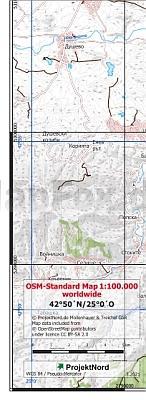
    ... gibt´s hier. Weltweit.


    Dieser Sitzball ...
    ... ist ein detaillierter Globus


    Die Welt ist ein Geschenkpapier


    Deutschland in 1000 Teilen
    ... unser schönstes Panorama-Puzzle


    Magnetpuzzle WELT


    Vianina Stadtplan-Poster


    Historische Landkarten


    Schicke Taschen


    Foxxi der Kuschelfuchs
    Der MapFox-Fuchs jetzt auch zum Kuscheln!


    Schreibtisch-Unterlagen
    So prägt sich die Deutschlandkarte ein!


    Landkarten-Puzzles
    Wunderschöne Geschenkidee für helle Köpfchen ab 5 J.


    Die Welt aus dem All
    Dekorative Satellitenbild-Poster in gestochen scharfer Auflösung!